
by William Eric McFadden
From the Daniel Boone National Forest website:
-
The Daniel Boone National Forest embraces some of the most rugged terrain west of the Appalachian Mountains. Steep forested slopes, sandstone cliffs and narrow ravines await!
From the Red River National Wild and Scenic River website:
-
Located in the Cumberland Plateau, the Red River Corridor reaches from the Ky. 746 bridge to the mouth of Swift Camp Creek. Approximately one half of this corridor is within the boundary of the Daniel Boone National Forest's Red River Gorge Geological Area. The Red River Gorge has an estimated 500 miles of trails. This area provides a plethora of recreational resources including hiking, climbing, paddling, camping, fishing, as well as other outdoor activities.
Pictures
- Morning fog in the valley as viewed from the lodge
- The tree blocking the road
- Nada Tunnel Road
- Nada Tunnel: eastern portal | western portal
- Eric operating; photo by Miles McFadden
- Flowers; photo by Miles McFadden
- Sheltowee Trace trailhead marker; photo by Miles McFadden
Description
On Saturday, August 3, 2024, two members of the Southeast Ohio Radio Adventure Team performed a successful two-fer activation of Daniel Boone National Forest and Red River National Wild and Scenic River in Kentucky as part of the Parks on the Air (POTA; link) program.
While in the Red River Gorge area of Kentucky for a family gathering, Eric McFadden, WD8RIF, and Miles McFadden, KD8KNC, visited Red River National Wild and Scenic River within the Daniel Boone National Forest for the activation. This would be the first CW activation of Red River National Wild and Scenic River.
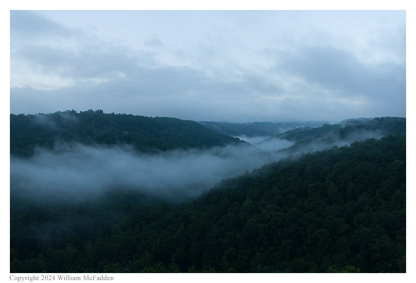
An early morning view of foggy Daniel Boone
National Forest wilderness area from the
spectacularly-located Forest View Lodge (info).
Eric's plan had been to visit the Copperas Creek Canoe Launch (map) which, based on his research, appeared to be within Daniel Boone National Forest (US-4484), Red River National Wild and Scenic River (US-10104), and Clifty Wilderness Area (US-3801), to perform a three-fer activation, and then to hike the nearby Sky Bridge Trail. However, on the way to Copperas Creek Canoe Launch, Eric and Miles came upon a fallen tree blocking Red River Road and, since they didn't have the time to take the 45-minute (or longer) detour, they were unable to reach Copperas Creek Canoe Launch. (The pair did discuss trying to use the car and a nylon tow-strap to pull the tree off of the road but, lacking a chainsaw, that task looked to be impossible.)
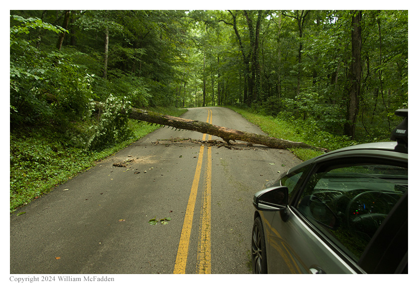
Jimmy-jacked! A fallen tree prevents the intrepid
duo from reaching Copperas Creek Canoe Launch.
While searching for an alternate location for an activation, a location that might allow a two-fer activation of Daniel Boone National Forest and Red River National Wild and Scenic River, or a two-fer activation of Daniel Boone National Forest and Clifty Wilderness Area, Eric and Miles discovered the spectacular, 900' long, hand-hewn, single-lane, historic Nada Tunnel (Wikipedia). The discovery of Nada Tunnel, and the opportunity to drive on the truly amazing sports-car roads in the Red River Gorge Geographical Area within Daniel Boone National Forest, more than made up for the inability to perform the planned three-fer activation.
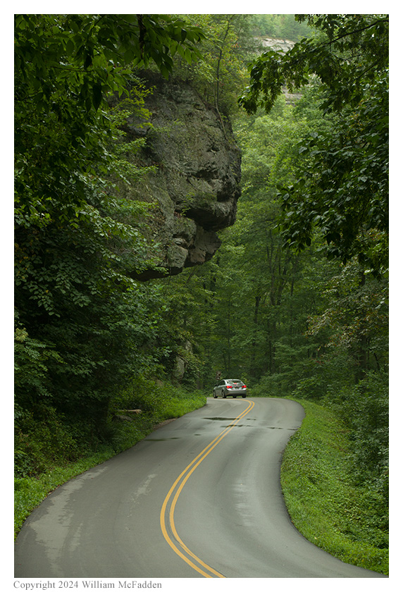
A true driver's road!
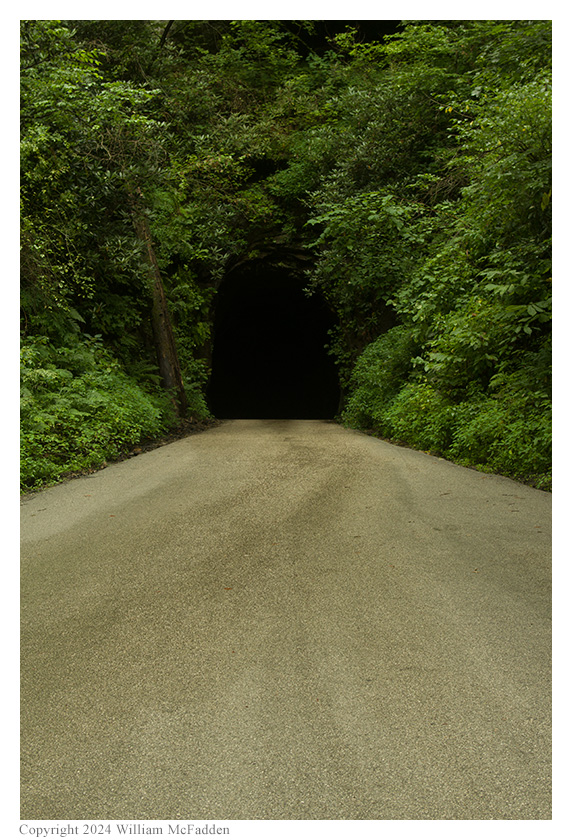
The eastern portal of Nada Tunnel.
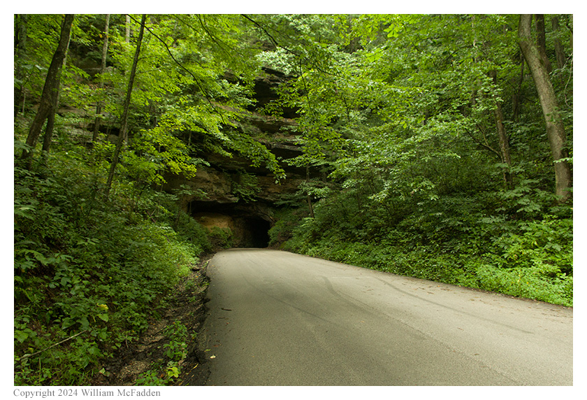
The western portal of Nada Tunnel.
While visiting the Gladie Visitor Center to report the fallen tree, Eric and Miles learned from a volunteer that Copperas Creek Canoe Launch isn't, despite Eric's research, located within Clifty Wilderness Area, so a three-fer activation wouldn't have been possible at that location, anyway. The volunteer provided information on several nearby locations that would allow for two-fer activations of Daniel Boone National Forest and Red River National Wild and Scenic River. Of these, Eric and Miles chose to check out the Sheltowee Trace suspension-bridge trailhead parking area, in the hope that a three-fer activation of Daniel Boone, Red River, and Sheltowee Trace could be performed.
At the trailhead parking area, Eric scouted out locations for an activation. He quickly came to the conclusion that, unless he wanted to hike a considerable distance on the Sheltowee Trace with his gear, an activity he no longer had time to do thanks to the time lost because of the fallen tree, there was no location at the trailhead parking area where he could be within 100' of both the Sheltowee Trace and the Red River simultaneously. Having performed an activation of Sheltowee Trace the previous weekend (link) while he and Miles were in the area supporting the Boone Forest Rally, Eric chose to set up his station on the bank of the Red River abd perform a two-fer activation of Red River National Wild and Scenic River and Daniel Boone National Forest.
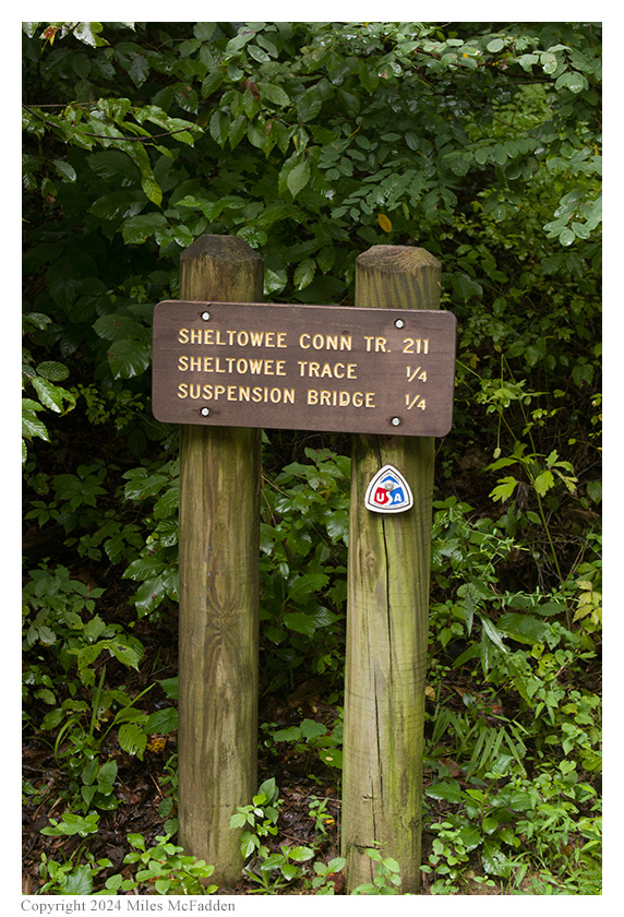
The Sheltowee Trace Trailhead
marker; photo by Miles McFadden.
Placing his folding camp-chair on a flat area on the river bank, Eric and Miles deployed a 28½' end-fed random wire as a vertical on a 31' Jackite telescoping fibrglass mast strapped to the camp-chair and, because of the undergrowth, placed only two 17' counterpoise wire on the ground. Placing his Elecraft KX2 on the camp-chair's flip-up table, Eric was on the air at 1418 UTC.
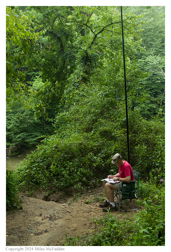
Eric operating; photo by Miles McFadden.
Eric found he absolutely no cell signal at this location and he would be unable to spot himself on POTA Spots (link) or to use POTA Spots to identify possible park-to-park (P2P) QSO opportunities. Because he had anticipated having poor cell signal, he had previously announced his activation on POTA Spots with the hope that he would be auto-spotted when he started calling CQ.
Eric began his operation on 20m. Finding himself a clear frequency to run, Eric began calling "CQ POTA", hoping that he would be auto-spotted on POTA Spots. Eric's first QSO came at 1421 UTC with K9OT in Wisconsin. His second QSO came at 1424 UTC with NT0C in Missouri; NT0C confirmed that Eric that was, in fact, spotted on POTA Spots. Despite elevated solar A-Index and K-Index values, QSOs came steadily, with Eric's eleventh QSO coming at 1442 UTC with NE1D in Massachusetts. This run included a P2P QSO with WB3GCK who was activating Ridley Creek State Park (US-1414) in Pennsylvania, a P2P QSO with KB3WAV who was performing a three-fer activation of Washington Monument State Park (US-1604), South Mountain State Battlefield State Park (US-6390), and Appalachian Trail National Scenic Trail (US-4556) in Maryland, and QSOs with operators located in Wisconsin (3), Missouri, Florida, Pennsylvania (2), Ohio, New Jersey, Maryland, and Massachusetts.
Because of the time lost due to the fallen tree, and because it looked as if rain could start at any moment, Eric chose to not try any other bands. (Indeed, rain began to fall just as they began tearing down the station.)
In all, Eric logged eleven QSOs, and made four P2P QSOs including KB3WAV's three-fer. All of Eric's QSOs were CW and were made with five watts output.
Miles did not operate but helped with navigation, helped with station set-up and tear-down, and did most of the activation photography.
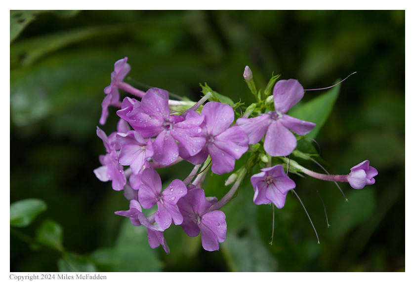
Flowers; photo by Miles McFadden.
Eric also submitted his log to the World Wide Flora and Fauna in Amateur Radio (WWFF; link) program for an operation at Daniel Boone National Forest, KFF-4511.
(return)