
by William Eric McFadden
From the Strouds Run State Park website:
-
Strouds Run State Park is located in the scenic forested hills of Athens County, in the midst of the unglaciated Appalachian Plateau. Although untouched by the vast ice sheets that moved across portions of the state over 12,000 years ago, Strouds Run displays the effects of the glaciers -- in the deep ravines and high hills -- where the valleys served as outlets for torrents of glacial meltwaters. The erosive power of these waters carved the valleys and hillsides, creating the familiar topography Ohioans know today. Large deposits of glacial outwash, primarily sand and gravel, were deposited along these streams and strongly affected the type of biological communities present today.
Sandstone, the principal bedrock outcropping in the region, is very resistant to erosion and forms the uplands and steep sides of the valleys. Twisting roads and forest trails pass through these deep ravines and lead to dense stands of beech, hickory, oak, maple and tuliptree. Seasonal displays are offered by flowering dogwood, redbud and spring wildflowers -- with fall presenting a pageant of colorful foliage. These woods are home to white-tailed deer, fox, raccoon, opossum, squirrel, wild turkey and a variety of songbirds. Woodthrush, white-breasted nuthatch, scarlet tanager, pileated woodpecker and the rufous-sided towhee inhabit the forest canopy. These rugged hills and woodlands are truly reminiscent of the wilderness that characterized the Ohio country in the days of early settlers.
Pictures
Description
On Saturday, September 7, 2024, one member of the Southeast Ohio Radio Adventure Team performed a successful activation of Strouds Run State Park (K-1994) as part of the Parks on the Air (POTA; link) program. While members of the Athens County Amateur Radio Association participated in an Ohio State Parks on the Air (OSPOTA, link) SSB-only activation of Strouds Run State Park (SRN) as W8UKE (link), Eric McFadden, WD8RIF, performed his own POTA CW activation of Strouds Run State Park (US-1994). ACARA-member Len Touth, W8VQ, also performed his own POTA CW activation of the park.
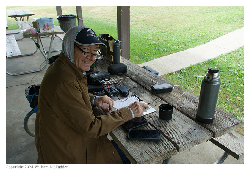
Eric, who is president of ACARA and served as captain for this year's OSPOTA operation, arrived at the Bulldog Picnic Shelter shortly before 1300 UTC to begin setting up the ACARA's OSPOTA station. The ACARA's station would consist of the club's Elecraft K3 transceiver and a Chameleon EMCOMM III Portable Antenna hung as a low sloper between a corner of the picnic shelter and a tree; power would be provided by a Honda 2kW inverter-generator.
Once the club's OSPOTA station was set up, both Len and Eric turned their attention to setting up their own stations to be used for CW POTA activations.
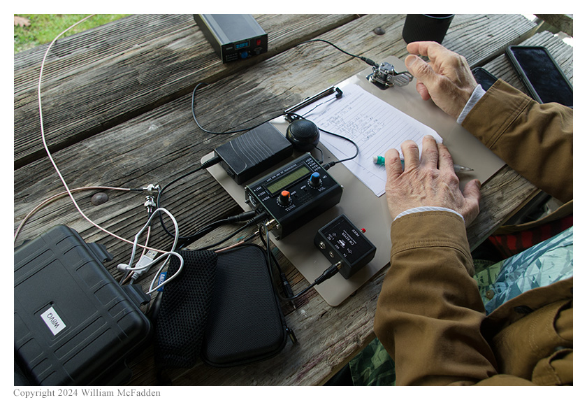
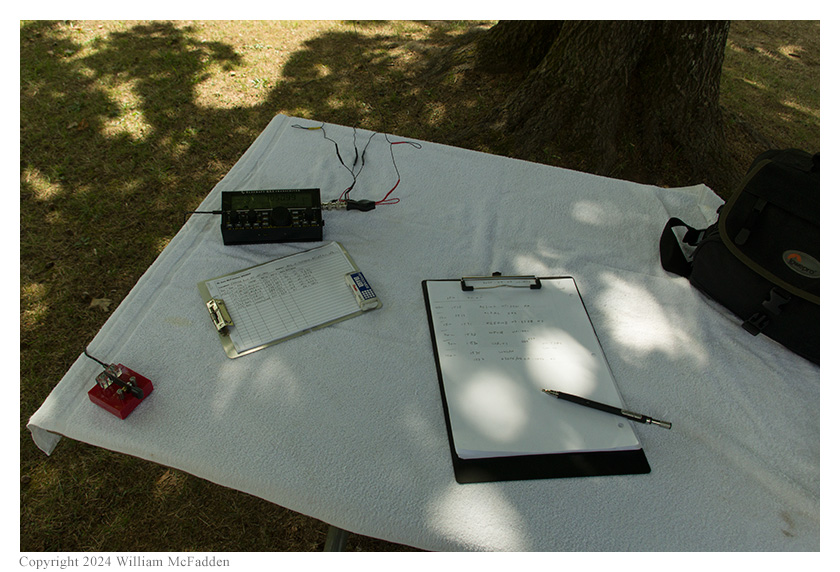
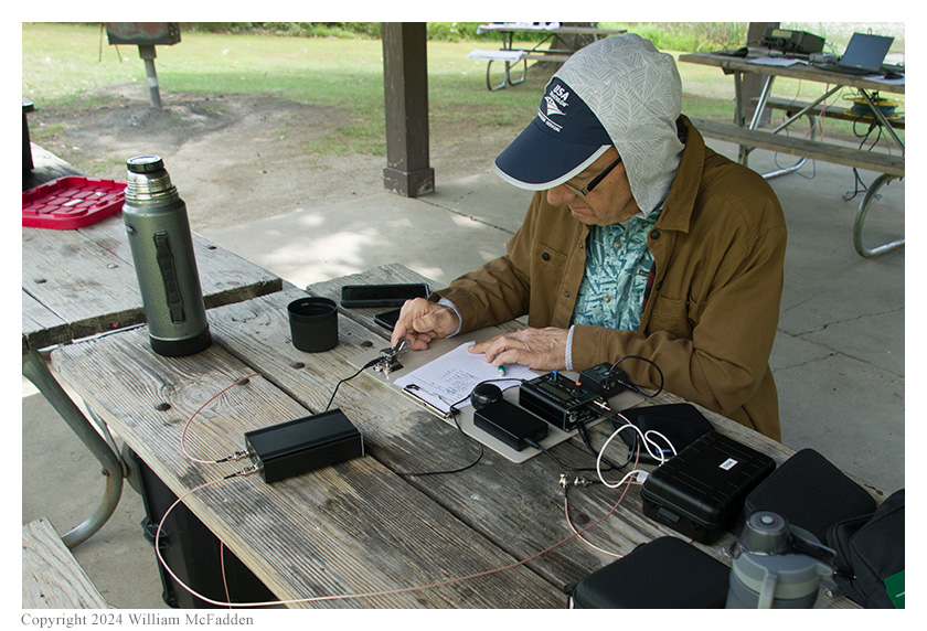
Len's station consisted of a Chinese µSDX transceiver and a 40m end-fed halfwave (EFHW) antenna supported as an inverted-vee on a SOTA Beams Carbon 6 Mast. Eric's station consisted of his Elecraft KX2 and a Tufteln (link) 35' end-fed random wire (EFRW) antenna sloping up to the top of his Goture Red Fox Super Hard 720 carbon-fiber mast with three 17' counterpoise wires thrown directly on the ground.
Len's tiny CW station.
Eric's Elecraft KX2 station.
Len began his operations first, starting on 20m, and quickly completed ten QSOs to validate his POTA activation. Not wanting to QRM Len, Eric started out hunting park-to-park (P2P) QSOs on the other bands, but he also made a very short run on 40m calling "CQ", which resulted in a single QSO. Later, when Len had finished on 20m, Eric was able to hunt P2P QSOs on that band, too. Over the eight hours of the OSPOTA event, while also participating in the ACARA's OSPOTA operation, conversing with other ACARA members and visitors, and enjoying the early Autumn weather, Len and Eric each completed over twenty CW POTA QSOs using their respective stations.
Len operates.
Eric's log:
40m cw 1515 AC3WM 539 559 POTA US-1401 (Point State Park)
                             + US-4564 (Potomac Heritage Trail National Scenic Trail)
                             + US-4572 (Lewis and Clark National Historic Trail)
17m cw 1519 KL7AC 539 599 POTA US-7234 (Harding Lake State Recreation Site)
15m cw 1521 KG5OWB 599 599 POTA US-2758 (Fort Abraham Lincoln State Park)
20m cw 1527 W8VQ 599 599 POTA US-1994 (Strouds Run State Park)
30m cw 1530 W0ITT 559 559 POTA US-5706 (Little Dixie Lake State Conservation Area)
40m cw 1534 W4LPH 539 569 POTA US-2747 (Mount Mitchell State Park)
40m cw 1527 N2EPE/VE3 559 539 POTA CA-1046 (Rattlesnake Point Conservation Area)
                                 + CA-0063 (Niagara Escarpment Biosphere Reserve)
40m cw 1549 KE8PAG 579 549
20m cw 1558 NZ5K 599 579 POTA US-7283 (DeQueen Lake Wildlife Management Area)
20m cw 1600 KJ7DT 539 559 POTA US-9147 (Farewell Bend State Recreation Area)
                             + US-4576 (Oregon National Historic Trail)
20m cw 1626 N0DET 539 549 (SOTA)
30m cw 1713 W5R 339 339 POTA US-11820 (Miller Brothers 101 Ranch Historic Site)
20m cw 1728 K7SHR 599 229 POTA US-10840 (Gebo-Causley Historic Mining District BLM Interpretive Site)
20m cw 1926 K5OHY 539 329 POTA US-10272 (Bush Family Home State Historic Site)
20m cw 1931 WB0RLJ 599 599 POTA US-2614 (Eugene T. Mahoney State Park)
20m cw 1933 W4LOO 539 559 POTA US-3080 (Jordanelle State Park)
20m cw 1937 AD4GN 599 559 POTA US-1843 (Bulow Creek State Park)
20m cw 1939 N0EVH 599 559 POTA US-5710 (Platte Falls State Conservation Area)
20m cw 1942 WX0X 559 599 POTA US-1120 (Woolly Hollow State Park)
20m cw 2017 NB0W 599 579 POTA US-11273 (Pressey Wildlife Management Area)
20m cw 2055 KC0DWZ 599 559 POTA US-2530 (William O'Brien State Park)
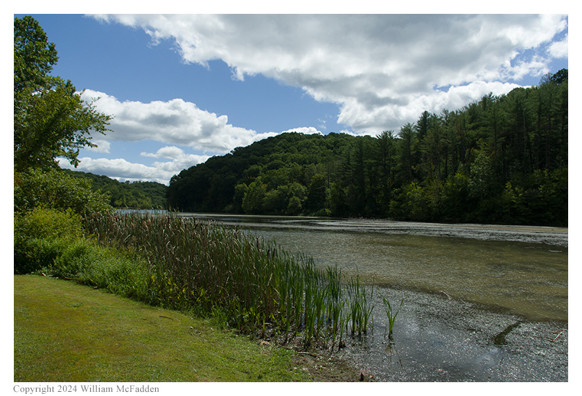
A view of Dow Lake.
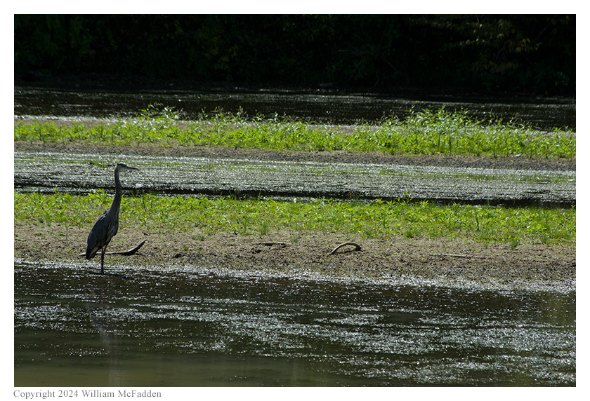
A heron.
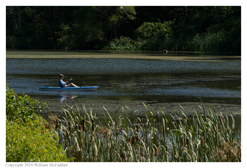
A kayaker.
Eric also submitted his log to the World Wide Flora and Fauna in Amateur Radio (WWFF; link) program for an operation at Strouds Run State Park, KFF-1994.
(return)