
by William Eric McFadden
From the nature preserve's website:
-
Rockbridge Natural Bridge originated millions of years ago, when Ohio lay under a warm inland sea. Rivers flowed into the vast body of water, carrying both fine and coarse grained sands which settled to the sea bottom. Over the centuries, the accumulating sand thickened, compressed and formed the hard sedimentary rock known as Black Hand sandstone. Eventually, great pressure from beneath the earth's surface caused the land in eastern North America to rise, forming the Appalachian Mountains. The inland sea soon drained away, exposing the newly uncovered rock layers to steady erosional processes. The natural bridge soon began emerging in all its grandeur. Wind, rain and percolating groundwater worked together for centuries, carving a deep cave-like recess in the softer midportion of the Mississippian Black Hand sandstone. Gradually, erosional forces also worked along a natural joint plane some distance behind the brink of the cliff. Over the centuries, this ongoing process has widened the crevice, and all that remains of the overhanging ledge is the narrow rock arch.
Pictures
Description
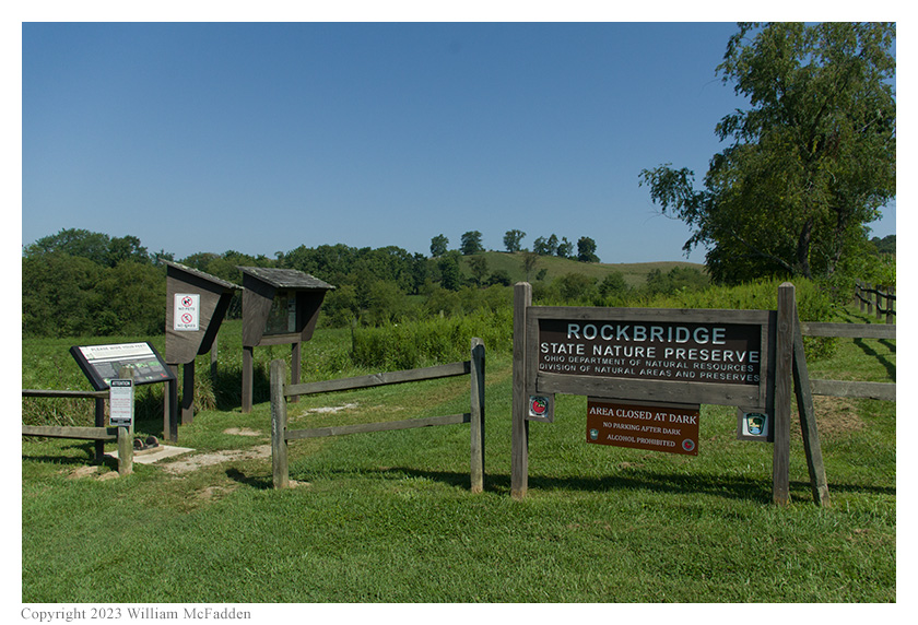 On Sunday, August 20, 2023, one member of the Southeast Ohio Radio Adventure Team
performed a successful activation of Rockbridge State Nature Preserve in Ohio as part of the Parks on the
Air (POTA; link) program.
On Sunday, August 20, 2023, one member of the Southeast Ohio Radio Adventure Team
performed a successful activation of Rockbridge State Nature Preserve in Ohio as part of the Parks on the
Air (POTA; link) program.
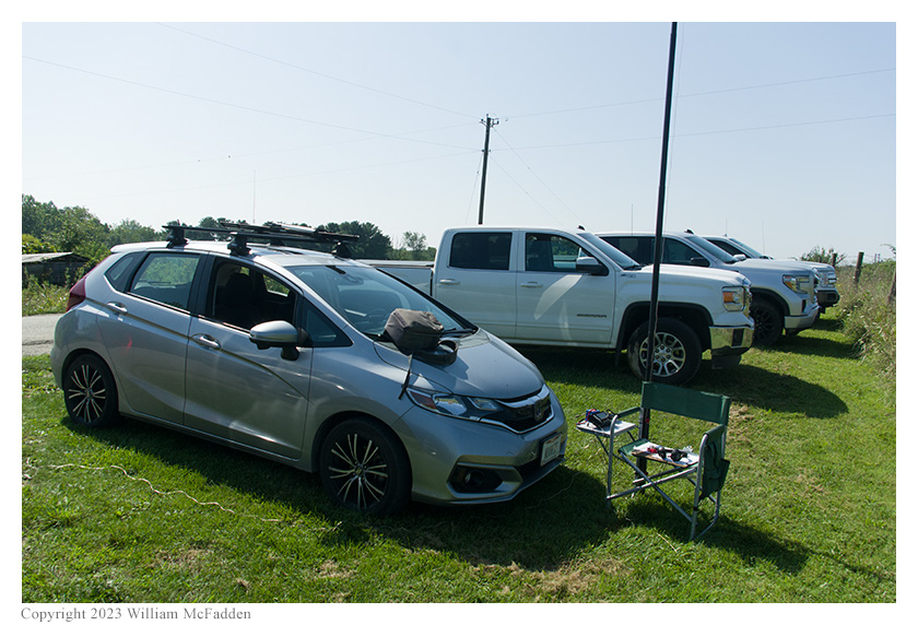
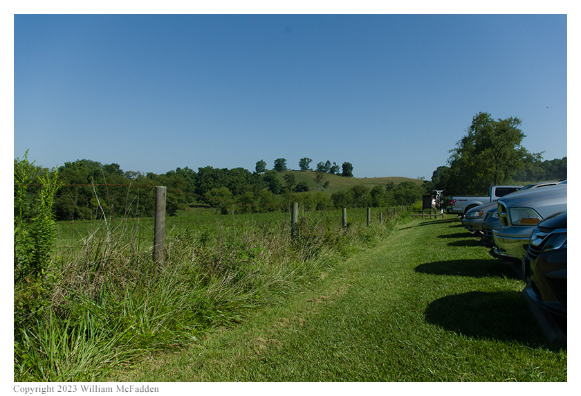
While on his way to Granville to help his parents move house, and following a successful activation of Lake Logan State Park (link), Eric McFadden, WD8RIF, stopped at the nature preserve for a quick activation. Arriving about 1415 UTC, Eric found the gravel parking area to be full. Parking his car on the grass adjacent to the gravel parking area, Eric deployed his 28½' wire vertical on a Jackite 31' telescoping fiberglass mast strapped to his folding camp-chair. Setting up his Elecraft KX3 on the folding camp-chair's small table, Eric was on the air at 1433 UTC.
 As at his previous activations of this park, Eric had good cell-signal and would be able able to spot
himself on POTA Spots (link) and to use POTA Spots to identify possible
park-to-park (P2P) QSO opportunities.
As at his previous activations of this park, Eric had good cell-signal and would be able able to spot
himself on POTA Spots (link) and to use POTA Spots to identify possible
park-to-park (P2P) QSO opportunities.
Eric began his operation on 20m by finding a clear frequency to run, spotting himself to POTA Spots, and calling "CQ POTA". His first QSO came at 1435 UTC with WI5D in Montana. QSOs came quickly, with Eric's seventh QSO coming at 1443 UTC with K5FNQ. This run included QSOs with operators located in Missouri, Texas, Maine, Rhode Island, California, and Louisiana.
Pausing to check POTA Spots for P2P QSO opportunities, at 1445 UTC Eric completed a P2P QSO on 20m with K8LSB in Tunxis State Forest (K-6874) in Connecticut. This was followed at 1451 UTC by a two-fer P2P QSO on 20m with K7UPJ on the George S. Mickelson State Trail (K-8164) within Black Hills National Forest (K-4524) in South Dakota. Finally, at 1451 UTC, Eric completed a P2P QSO on 40m with KD3D at Elk State Forest (K-5467) in Pennsylvania.
 Returning to run a frequency on 20m, Eric's first QSO in this run came at 1456 UTC with K7ULM in
Montana. QSOs came quickly, with Eric's ninth QSO in this run being a P2P QSO at 1503 UTC with K5TER
at Possum Kingdom State Park (K-3049) in Texas. This run included a P2P QSO with NF1T at Sawgrass
Lake Park State Conservation Area (K-6700) in Florida, a P2P QSO with KB4MIS also at Sawgrass Lake
Park State Conservation Area (K-6700) in Florida, and QSOs with operators located in Montana,
Nebraska, North Dakota, Florida (4), Texas, and Quebec.
Returning to run a frequency on 20m, Eric's first QSO in this run came at 1456 UTC with K7ULM in
Montana. QSOs came quickly, with Eric's ninth QSO in this run being a P2P QSO at 1503 UTC with K5TER
at Possum Kingdom State Park (K-3049) in Texas. This run included a P2P QSO with NF1T at Sawgrass
Lake Park State Conservation Area (K-6700) in Florida, a P2P QSO with KB4MIS also at Sawgrass Lake
Park State Conservation Area (K-6700) in Florida, and QSOs with operators located in Montana,
Nebraska, North Dakota, Florida (4), Texas, and Quebec.
In all, Eric made twenty QSOs, including seven P2P QSOs, in thirty minutes of on-air time. All of Eric's QSOs were CW and were made with five watts output.
(return)