
by William Eric McFadden
From the Clear Fork Gorge State Nature Preserve website:
-
The 29-acre Clear Fork Gorge State Nature Preserve is situated along the north bluff of the Clear Fork of the Mohican State Scenic River. The white pine-hemlock forest community here, although only 8 acres in extent, is one of the best remaining woodlands like this in the state.
Huge native white pines and eastern hemlocks grow on the steep sides of the gorge wall. In addition to rare nesting warblers, one of the most interesting species observed here is the round-leaved orchid.
From the Mohican-Memorial State Forest website:
-
Mohican-Memorial State Forest comprises 4,541 acres in Ashland County. Mohican-Memorial State Forest features 32 miles of hiking trails, 22 miles of bridle trails, 8 miles of snowmobile trails, a 24-mile mountain biking trail, 10 "Park and Pack" primitive campsites, the Memorial Forest Shrine, a fire tower, and the 1.5-mile Discovery Forest interpretive trail. The natural attributes of the Mohican area combined with state and nearby commercial facilities have made this region one of the more popular year-round attractions of the state.
Pictures
- Entering Hog Hollow Trail
- The Clear Fork Gorge sign
- A large millipede at the Clear Fork Gorge SNP sign and kiosk
- Eric's station: 1 | 2
- Eric operating: 1 | 2; photos by Miles McFadden
Description
On Sunday, July 9, 2023, two members of the Southeast Ohio Radio Adventure Team performed a successful two-fer activation of Clear Fork Gorge State Nature Preserve (K-9398) and Mohican-Memorial State Forest (K-5444) in Ohio as part of the Parks on the Air (POTA; link) program.
There being no other access into Clear Fork Gorge State Nature Preserve, Eric McFadden, WD8RIF, and Miles McFadden, KD8KNC, hiked into the Clear Fork Gorge State Nature Preserve for the two-fer activation.
The pair arrived at the Mohican-Memorial State Forest firetower, loaded themselves up with the KX2 Mini Travel Kit, a 31' Jackite telescoping fiberglass mast, two folding camp-chairs, water bottles, a towel1, and sundries, and began the hike into the forest at the Hog Hollow Trail trailhead. The hike was not strenuous, but exposed tree roots and slippery pine needles underfoot made for less-than-secure footing in places. Turning right at the first fork to follow the white blazes, they eventually found the Clear Fork Gorge State Nature Preserve sign and informational kiosk.
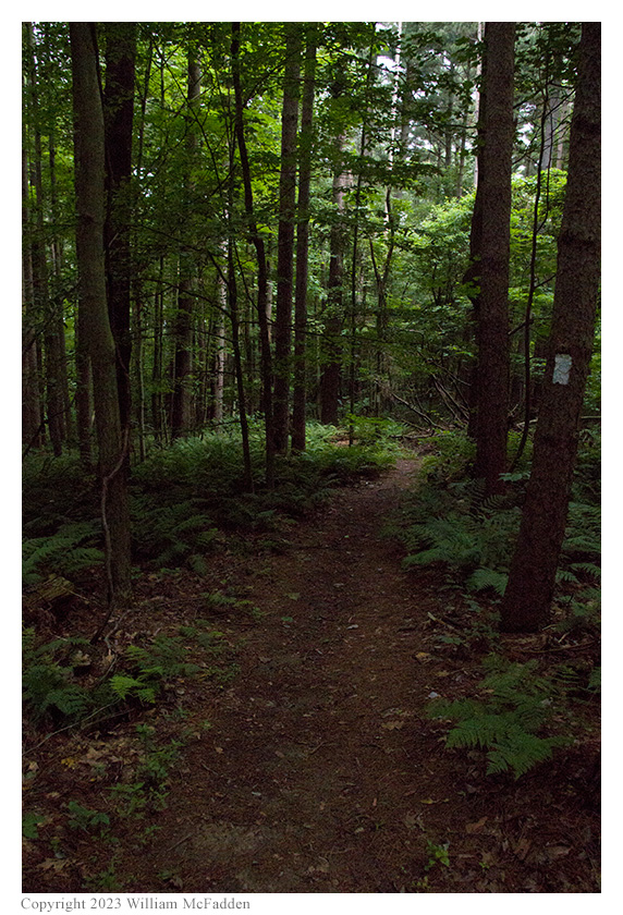
On Hog Hollow Trail
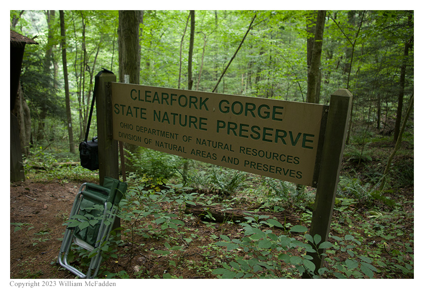
Welcome to Clear Fork Gorge State Nature Preserve!
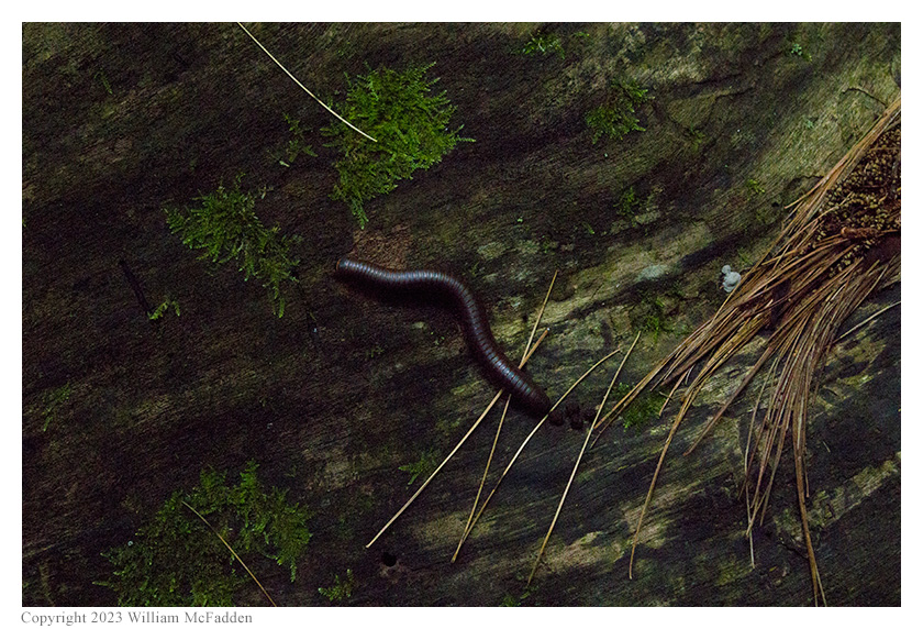
A large millipede.
Not wanting to inconvience other hikers by setting up at the sign and informational kiosk, the pair continued along the trail farther into Clear Fork Gorge State Nature Preserve. The trail was narrow, with steep up-hill on the left, and with steep-downhill on the right. Eventually, Eric identified a spot that could be made to work, while leaving the trail clear for other users.
Because he hasn't yet embraced throwing lines into trees, Eric chose to lean his 31' Jackite telescoping mast against an extremely tall pine tree and use the mast to support his Tufteln 35' End-Fed Random Wire (EFRW) antenna as a slightly sloping vertical. Placing his camp-chair against the trunk of a second tree, well below the base of the 31' mast, placing his KX2 on the camp-chair's flip-up table, and deploying the EFRW's single 17' counterpoise wire above-ground to a third tree, Eric was on the air at 1513 UTC.
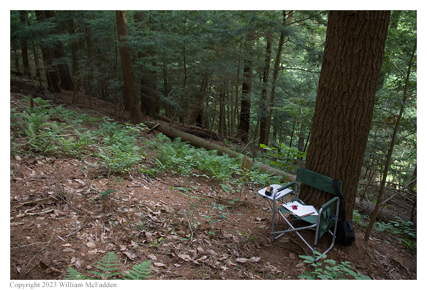
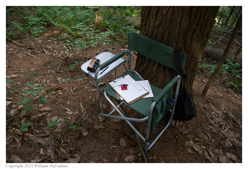
Eric's station.
Initially, when he was unable to send or receive SMS texts, Eric thought he had no cell-signal at this location but then was surprised to find he could access POTA Spots to spot himself and to identify possible Park-to-Park (P2P) QSOs. Eric eventually determined that he had unexpectedly used up all his TracFone prepay plan's SMS texts. Fortunately, Miles was present and able to text Eric's buddies Mike, K8RAT, and Thomas, K4SWL, as Eric selected frequencies to run.
Eric began his operation by checking POTA Spots for P2P QSO opportunities and at 1521 UTC he completed a QSO on 20m with K4NYM at Tenoroc Wildlife Area (K-6327) in Florida.
Finding himself his own frequency to run on 20m, Eric began calling "CQ POTA" and self-spotted himself on POTA Spots. His first QSO in this run came at 1525 UTC with inveterate hunter KJ7DT in Idaho. QSOs came quickly, with Eric's fourteenth QSO in this run coming at 1542 UTC with K7PYP in Idaho. This run included QSOs with operators located in Idaho (2), Florida (2), Illinois (2), Arkansas, Minnesota, Michigan, Louisiana (2), Rhode Island, New Jersey, and Montana.
Switching to 40m to run a frequency, Eric's first and only QSO there came at 1546 UTC with K3AHP in Pennsylvania.
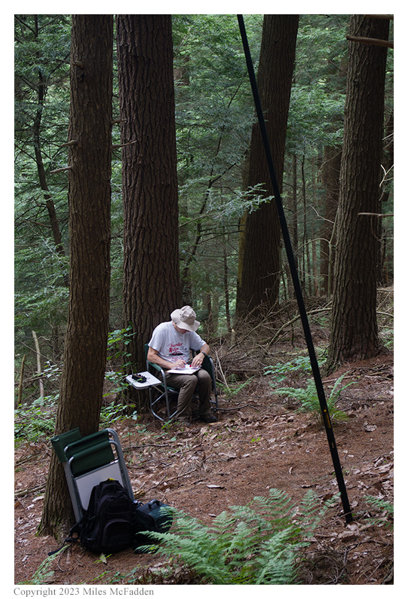
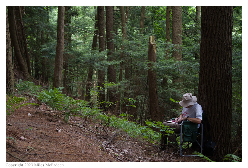
Eric operating; photos by Miles McFadden.
In all, Eric made sixteen QSOs, with one P2P QSO, in thirty-three minutes of on-air time. All of Eric's QSOs were CW and were made at five watts output.
Miles did not operate but helped carry gear, helped with station set-up and tear-down, and did much of the activation photography.
Here's the complete hike, out-and-back, as recorded by Strava. Extreme GPS jitter during the activation itself artificially increased the measured length of the hike. The operating location is in the middle of the large "clump". Eric estimates the actual distance hiked was closer to one mile, round trip.
This activation was Eric's first real test of his KX2 Mini Travel Kit, an operation in which spare bits weren't available in the car just a few feet away. Eric was pleased that both the KX2 transceiver itself and the kit built around it worked very well. He continues to be impressed with the Tufteln 35' EFRW antenna and its clever design—but he still thinks having the radiator and counterpoise wires made with brightly-colored wire that's easier to see would be a useful improvement.
Footnotes:
[1] "Listen. It's a tough universe. There's all sorts of people and things trying to do you, kill you, rip you off, everything. If you're going to survive out there, you've really got to know where your towel is." — Ford Prefect
(return)