- Hope Schoolhouse / Selinde Roosenburg Memorial Backpack Trailhead
- A grass-covered portion of the Moonville Rail Trail
- Folks getting ready to launch their boat (or pack it up?)
- Moonville Tunnel
- A fawn
- One of many bridges on the Moonville Rail Trail
- A small pond
- A small pond with historic M&C telegraph pole
- King's Hollow Tunnel

by William Eric McFadden
From the Moonville Rail Trail website:
-
This 10-mile rail trail takes visitors through the beautiful woodlands of southeast Ohio, including Zaleski State Forest; the communities of Zaleski and Mineral; and the Lake Hope State Park wetland areas. The corridor holds water on both sides of the trail, creating a wetland area that is home to numerous species of flora and fauna.
Additional points of interest along this trail are two unique and historic tunnels. King’s Hollow Tunnel (also known as King Switch Tunnel) is a 120-foot structure carved through the rock and lined by a series of 12x12 wooden beams. The Moonville Tunnel is brick-lined and has a long history of train accidents, earning the tunnel a reputation for being haunted.
From the Lake Hope State Park website:
-
Lake Hope State Park offers a truly relaxing, yet rustic getaway from the high speed of modern life. The entire 2,983-acre park lies within the Zaleski State Forest in the valley of Big Sandy Run. The park's heavily forested region is marked by steep gorges and narrow ridges with remnants of abandoned mining and iron-producing industries.
The park surrounds the lake and boasts a wooded family campground and a variety of year-round cabins for families and gatherings of all sizes, including the roomy Laurel Lodge. No visit to the park is complete without a stop in the dining lodge for a hearty meal.
From the Zaleski State Forest website:
-
The 27,822-acre Zaleski State Forest is the second largest forest in Ohio's system of state forests.
Zaleski State Forest operates the only state-owned sawmill in Ohio. The mill produces rough sawn lumber for use by Ohio's state forests and state parks as well as other government agencies.
Historic Moonville Tunnel is located within Zaleski State Forest on the Moonville Rail Trail right-of-way.
Pictures
- Outbound, along the Moonville Rail Trail:
- Outbound, in Lake Hope State Park:
- At Grouse Point Trailhead — The Activation:
- Inbound, along the Moonville Rail Trail:
Description
On Friday, May 26, 2023, one member of the Southeast Ohio Radio Adventure Team performed a successful bicycle-portable two-fer activation of Lake Hope State Park and Zaleski State Forest in Ohio as part of the Parks on the Air (POTA; link) program.
Eric McFadden, WD8RIF, rode the Moonville Rail Trail, on what used to be the Marietta & Cincinnati Railroad (wikipedia article) right-of-way, from the village of Mineral through Zaleski State Forest, diverted from the rail trail to ride to Grouse Point Trailhead in Lake Hope State Park for the two-fer activation of the state park and the state forest. This was Eric's first real gravel ride on his new "Narrow Knobby" tires and it was first test of carrying KX3 in the LowePro Nova 3 camera bag equipped with "Gravel Kirk" pannier-hooks from Universal Panniers (link).
Eric started his ride on the Moonville Rail Trail just about 1720 UTC and soon encountered the first landmark of the ride: the 120' long, timber-lined King's Hollow Tunnel.
A poor-quality snap of King's Hollow Tunnel.
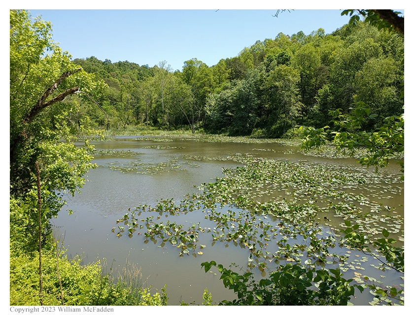
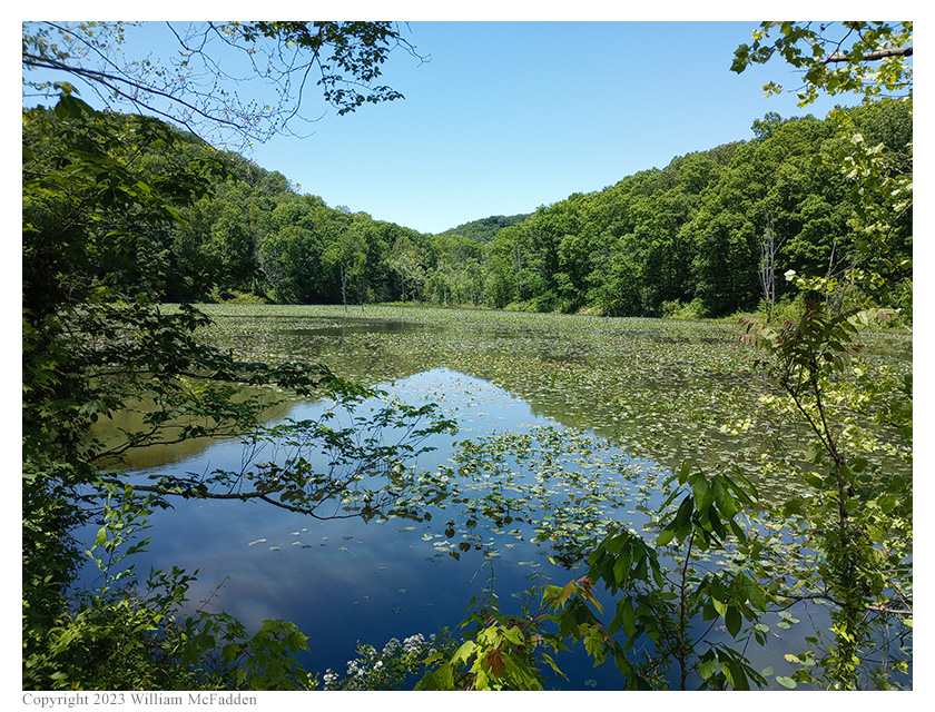
Riding through the very dark tunnel and continuing west on the Moonville Rail Trail, Eric soon came to a succession of ponds. Rumor has it that a pair of nesting eagles fish in these ponds, but Eric did not see or hear them on this occasion.
A small pond.
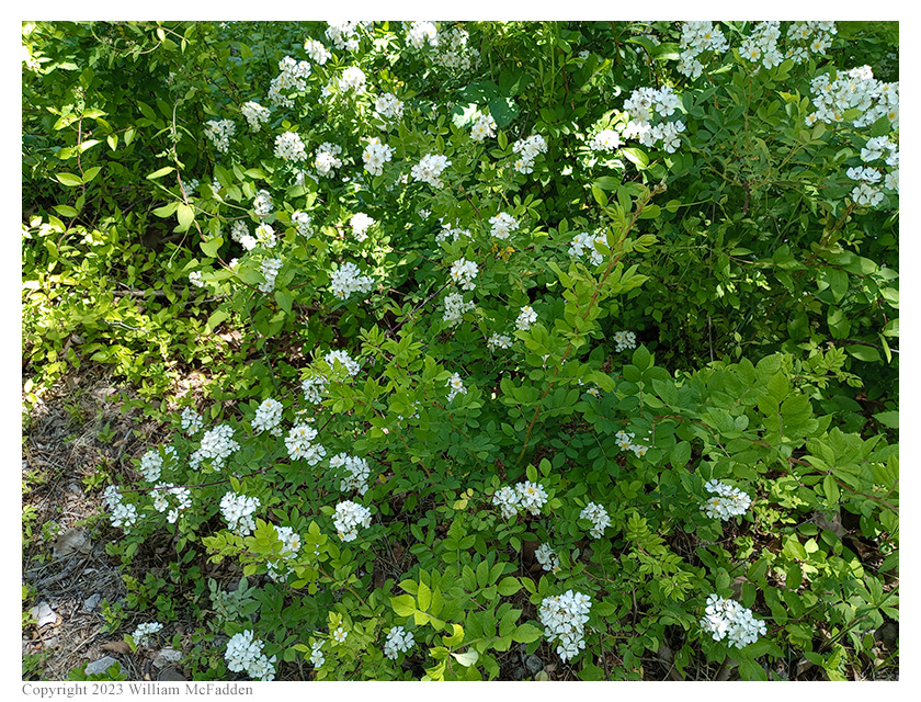
Flowers at the small pond.
The pond at Bear Hollow.
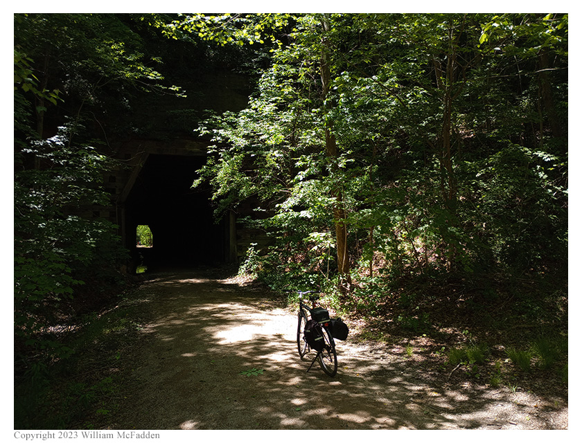
Continuing west on the smooth rail trail, and now well inside the Zaleski State Forest, Eric soon came upon the brick-lined Moonville Tunnel (info).
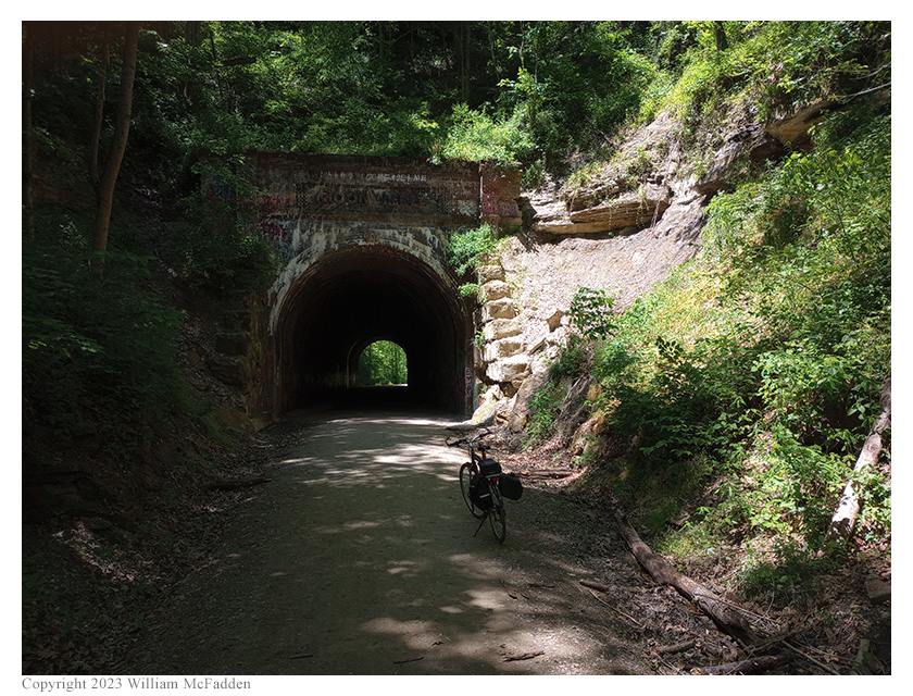
A contrasty snap of Moonville Tunnel.
After passing through Moonville Tunnel, Eric was forced to divert from the Moonville Rail Trail and follow the gravel forestry road before re-joining the Moonville Rail Trail about a mile further on. (When CSX abondoned the rail line, they took everything: rails, ties, ballast, and complete bridges. Two bridges west of Moonville Tunnel on the Moonville Rail Trail have yet to be re-installed, and the cost to do so might mean they never get installed.) Eric's new Narrow Knobbies were reassuring on the forestry road but the unsprung bicycle did not at all like the corrugations on the road.
Leaving the Moonville Rail Trail, Eric rode a short distance on Wheelabout Road to SR278 and then to the Lake Hope State Park entrance.
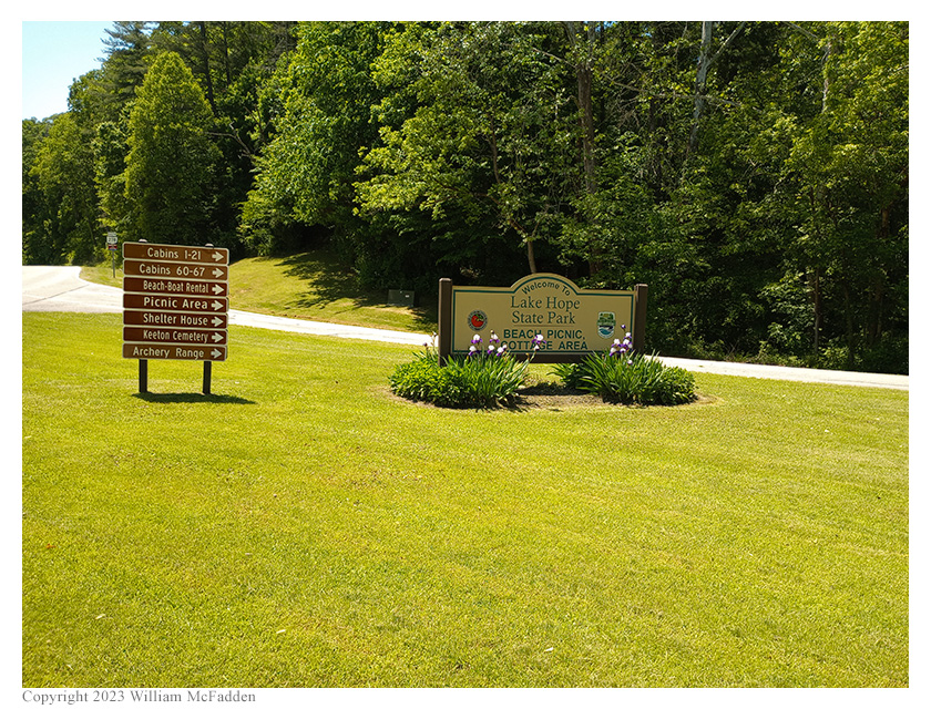
The Lake Hope State Park sign.
Climbing the long hill toward and then past Keeton Cemetery, Eric road to Grouse Point Trailhead to perform his two-fer activation, arriving at about 1824 UTC. Eric was pleased to find the trailhead area to be unoccupied.
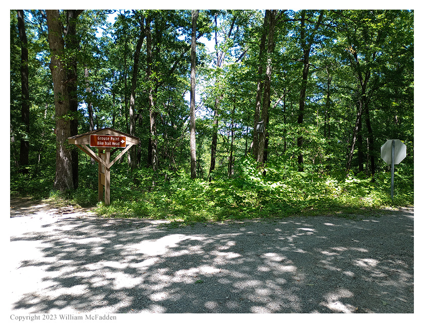
"This way to Grouse Point Trailhead."
Grouse Point Trailhead has a single picnic table and Eric, who had earlier decided not to bring along his small camping stools, was pleased to find the picnic table available.
Eric deployed his new Tufteln 35'/17' wire antenna as a sloper with the top of the 35' wire supported on his Goture Red Fox Super Hard 720 carbon-fiber mast securely bungeed to his bicycle, and the 17' counterpoise wire suspended a foot or two above the ground using a bit of deadfall. Eric deployed his KX3 on the picnic table and was on the air about 1840 UTC.
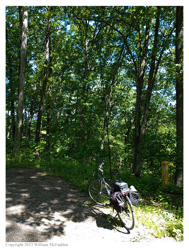
The mast supported on the bicycle.
It was at this point that Eric discovered that he had decent cell-signal but no working internet, so he was unable to spot himself to POTA Spots (link) or to use POTA Spots to check for park-to-park (P2P) QSO opportunities. (This is the fifth time Eric's phone has lost internet-over-cell since he purchased the phone less than four months ago; he's getting quite frustrated.) Eric had announced his activation on POTA Spots before leaving the house, in case he had to rely on auto-spots, and he was able to send and receive texts, enabling his buddy K8RAT to verify that Eric was properly spotted. (This ability to text with K8RAT was fortunate since solar conditions were absolutely trashing the HF bands.)
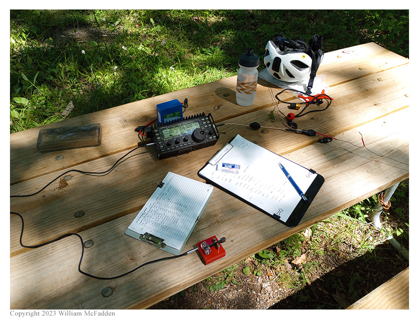
Eric's station.
As soon as Eric sat down to begin his operation, he felt a tickle and found a tick crawling on his leg. He suspects this unwelcome guest joined him when he stepped off the trail to deploy the 17' counterpoise wire. A quick search revealed no other such unwanted guests and Eric got down to the business of making QSOs.
Eric began his operations on 20m, finding himself a frequency to run, calling "CQ POTA", and texting his frequency to his buddy K8RAT. Either he was auto-spotted based on his POTA Spots announcement or K8RAT spotted him, because Eric's first QSO came at 1843 UTC with W3PYF who was performing a POTA activation of Assabet River National Wildlife Refuge (K-0320) in Massachusetts. QSOs came steadily, if not quickly, with Eric's seventh QSO coming at 1859 UTC with NN4DF who was performing a POTA activation of Bell Ridge Longleaf Wildlife Area (K-6290) in Florida. This run included a forced change of frequency when an Italian station started calling CQ on the frequency Eric had been running, and QSOs with operators located in Massachusetts (2), Minnesota, North Carolina, Ohio, Texas, and Florida. Most of these stations were quite weak in Eric's receiver.
Switching to 40m, Eric found a frequency to run and began calling CQ. His first QSO in this run came at 1906 UTC with N4DH in North Carolina. QSOs came steadily and a bit more quickly than they had on 20m, with Eric's sixth QSO in this run coming at 1915 UTC with his friend K8RAT in Ohio. This run included QSOs with operators located in North Carolina (3), Pennsylvania (2), and Ohio. The stations on 40m were quite a bit stronger than those on 20m.
In all, Eric made thirteen QSOs, with two P2P QSOs. All of Eric's QSOs were CW and were made at 5w output.
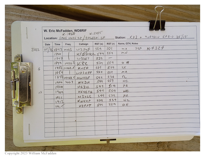
Eric's log.
This was Eric's second activation using the Tufteln 35'/17' End-Fed Random Wire (EFRW) antenna, the first being at Culberson Woods State Nature Preserve the week earlier (link). Both of these activations took place during very compromised HF conditions. Nevertheless, the small antenna worked well enough at both activations. Eric was quite impressed by the thought that went into the design and the building of the antenna. For example, both the 35' radiator and the 17' counterpoise wire feature quick-disconnects but the 9:1 transformer features two clips and each wire includes loops that together can be used to prevent the wires from pulling out. For this activation, Eric chose to not use this functionality because of the gusty wind at the trailhead on the ridgetop—if a gust were to blow his bicycle and mast over, Eric didn't want his KX3 to be pulled off the picnic table. The Tufteln 35'/17' EFRW might well become Eric's go-to antenna for bicycle-portable HF operations. (Full disclosure: the 35'/17' EFRW antenna and associated common-mode choke were an unexpected and unsolicted gift from Joshua, N5FY, the designer and builder of the Tufteln products.)
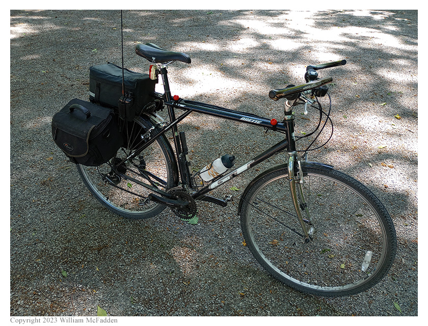
Eric's bicycle, packed for the ride back to Mineral.
The ride back toward Mineral included a stop at the historic Hope Schoolhouse (info) to take advantage of the available facilities.
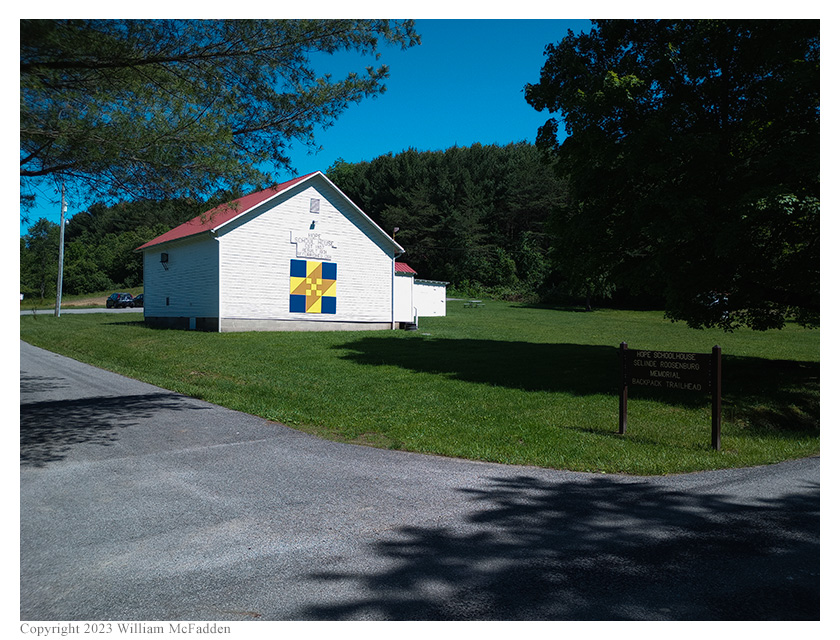
Hope Schoolhouse / Selinde Roosenburg Memorial Backpack Trailhead
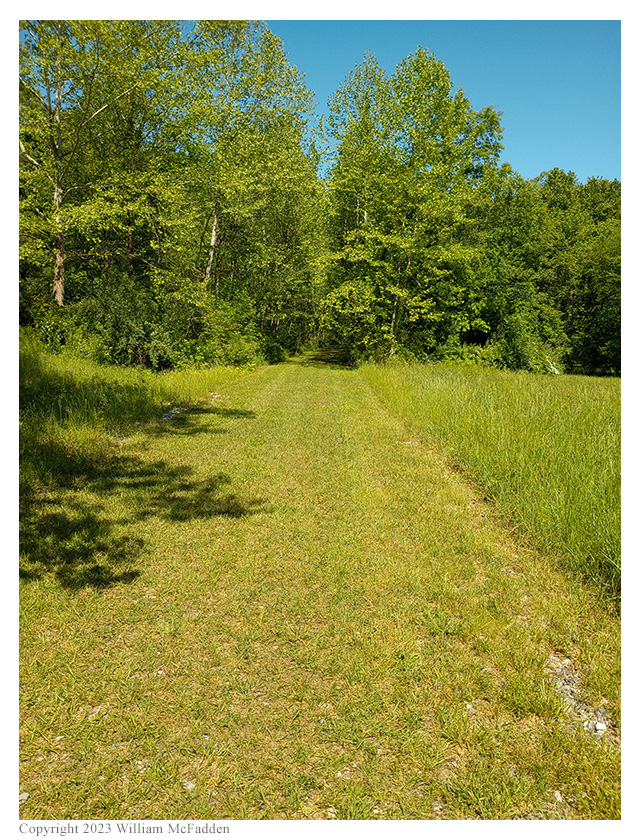
A grass-covered portion of Moonville Rail Trail.
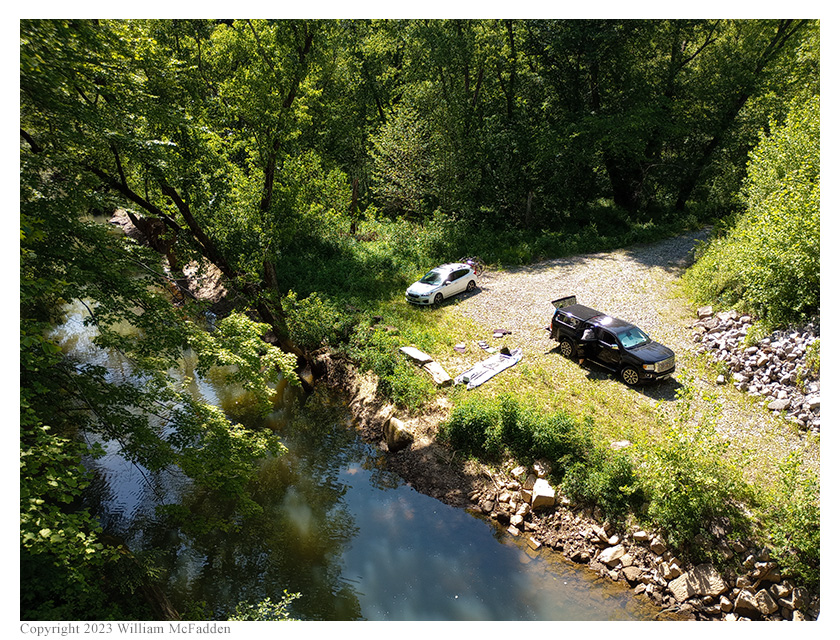
Boaters getting ready to launch their boat—or to pack their boat into their truck.
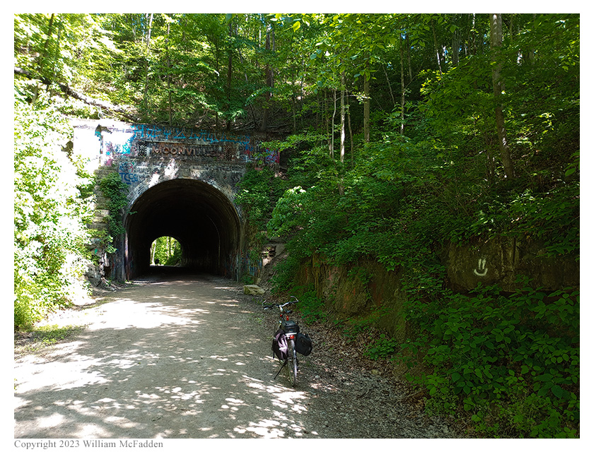
Moonville Tunnel.
While exiting Moonville Tunnel, Eric saw a doe run across the rail trail but her fawn stopped on the trail. The fawn didn't appear to be hurt, and Eric didn't approach her too closely or touch her.
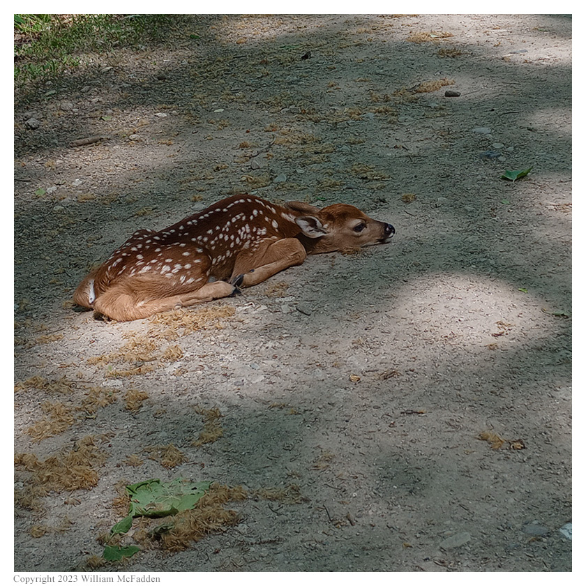
A fawn on the Rail Trail.
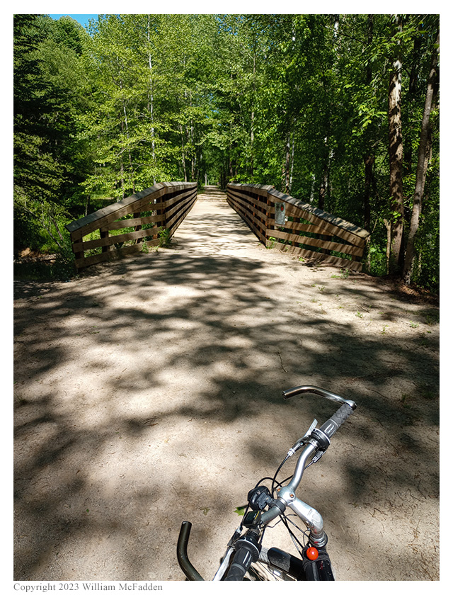
One of many bridges on the Moonville Rail Trail.
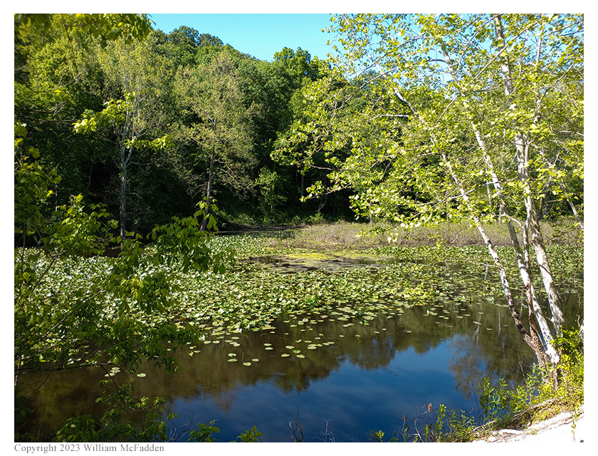
The pond at Bear Hollow.
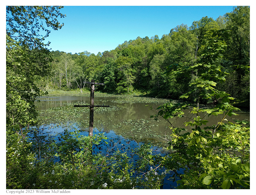
An ancient Marietta & Cincinnati Railroad telegraph pole alongside the Rail Trail.
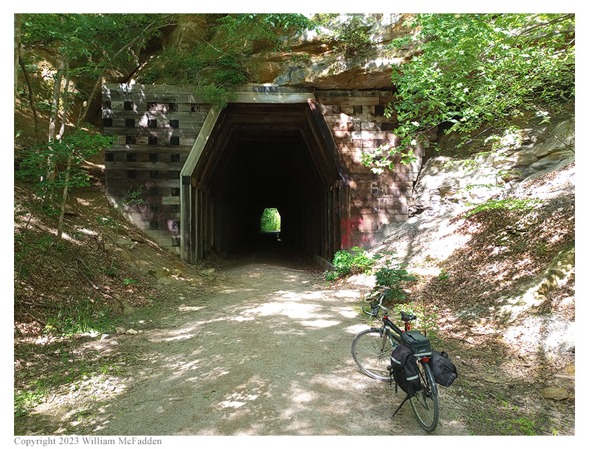
King's Hollow Tunnel.
In all, Eric rode almost 18 miles, mostly on gravel, and climbed 868', over not quite two hours of riding. He was pleased with the performance of his new Narrow Knobbies on the gravel. He was less pleased with the bicycle on the forestry road corrugations but suspects that slightly less tire pressure might help with these next time.
View the map of Eric's ride from Mineral to Grouse Point Trailhead:
View the map of Eric's ride from Grouse Point Trailhead to Mineral:
Eric was not entirely pleased with how the LowePro Nova 3 camera bag equipped with "Gravel Kirk" pannier hooks rode on the bicycle and suspects that lots of riding on rough roads would quickly wear out the bag at the pannier hook attachment points. He's going to give some thought to other ways to secure the Nova 3 to his bicycle—or come up with an entirely different bag for carrying the KX3 station on the bicycle.
(return)