Bike Your Park Day RATpedition!
From the Moonville Rail Trail website:
-
This 10-mile rail trail takes visitors through the beautiful woodlands of southeast Ohio, including Zaleski State Forest; the communities of Zaleski and Mineral; and the Lake Hope State Park wetland areas. The corridor holds water on both sides of the trail, creating a wetland area that is home to numerous species of flora and fauna.
Additional points of interest along this trail are two unique and historic tunnels. King’s Hollow Tunnel (also known as King Switch Tunnel) is a 120-foot structure carved through the rock and lined by a series of 12x12 wooden beams. The Moonville Tunnel is brick-lined and has a long history of train accidents, earning the tunnel a reputation for being haunted.
From the Zaleski State Forest website:
-
The 27,822-acre Zaleski State Forest is the second largest forest in Ohio's system of state forests.
Zaleski State Forest operates the only state-owned sawmill in Ohio. The mill produces rough sawn lumber for use by Ohio's state forests and state parks as well as other government agencies.
Historic Moonville Tunnel is located within Zaleski State Forest on the Moonville Rail Trail right-of-way.
From the Lake Hope State Park website:
-
Lake Hope State Park offers a truly relaxing, yet rustic getaway from the high speed of modern life. The entire 2,983-acre park lies within the Zaleski State Forest in the valley of Big Sandy Run. The park's heavily forested region is marked by steep gorges and narrow ridges with remnants of abandoned mining and iron-producing industries.
The park surrounds the lake and boasts a wooded family campground and a variety of year-round cabins for families and gatherings of all sizes, including the roomy Laurel Lodge. No visit to the park is complete without a stop in the dining lodge for a hearty meal.
From the Turkey Ridge Wildlife Area's website:
-
The 377-acre Turkey Ridge Wildlife Area is located in Brown Township, Vinton County. Turkey Ridge is approximately three miles south of the village of New Plymouth on State Route 328. Turkey Ridge Wildlife Area consists predominantly of clear-cut woodland within the Appalachian Foothills Focus Area, connects to Zaleski State Forest, and will be managed to provide forestland habitat. Turkey Ridge consists of 80 percent forestland, 19.5 percent open land, and less than one percent of wetlands and open water.
Pictures
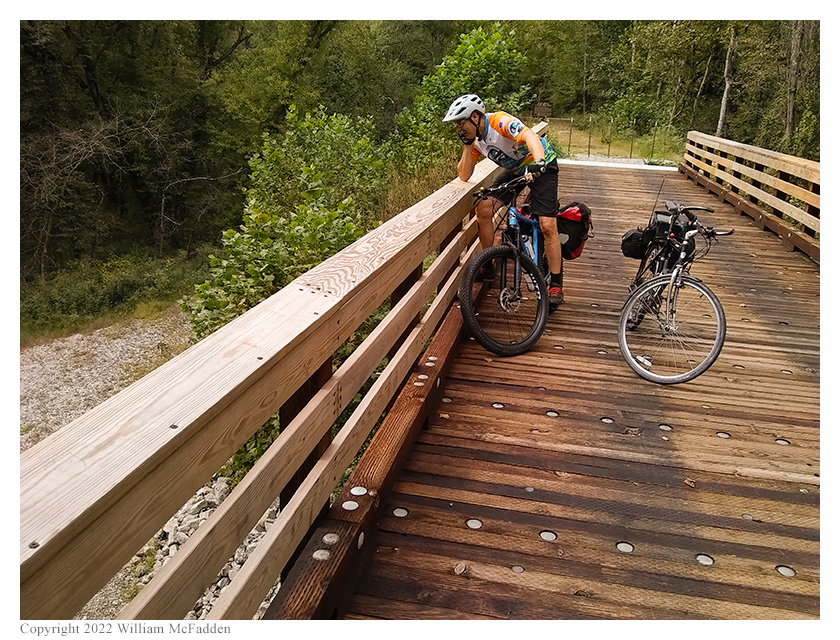
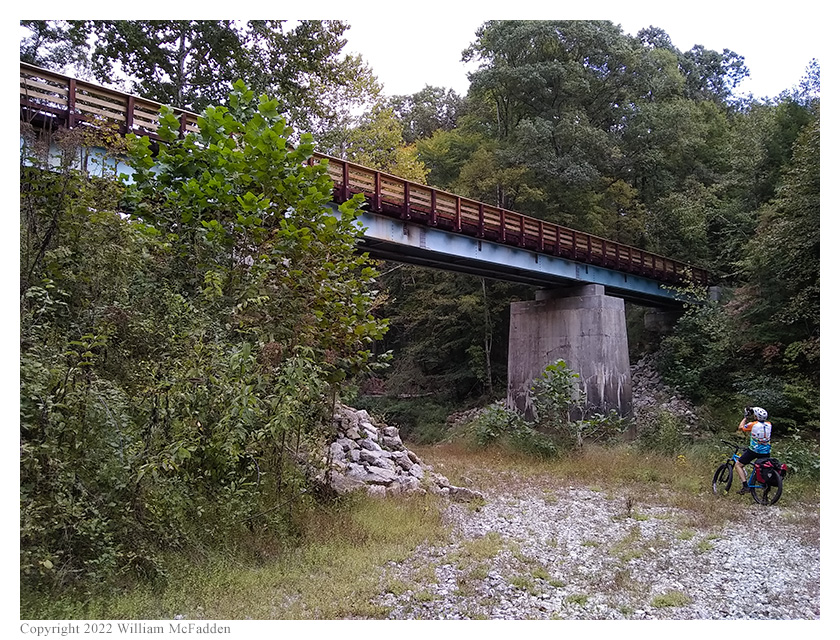
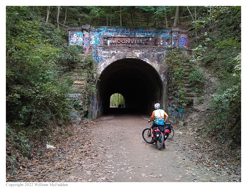
- Outbound, along the Moonville Rail Trail:
- In Lake Hope State Park:
- In Turkey Ridge Wildlife Area:
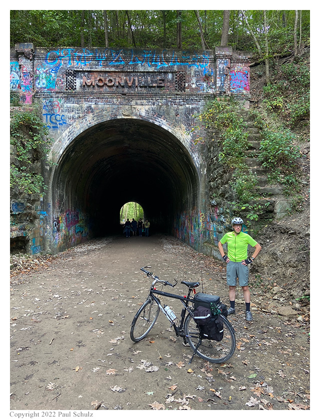
- Inbound, along the Moonville Rail Trail:
Description
On Saturday, September 24, 2022, one member of the Southeast Ohio Radio Adventure Team
performed successful bicycle-portable activations of Zaleski State Forest, Lake Hope State Park, and Turkey
Ridge Wildlife Area in Ohio as part of the Parks on the Air (POTA; link) program.

While participating in the Adventure Cycling Association's annual Bike Your Park Day (info),
Eric McFadden, WD8RIF, rode the Moonville Rail Trail, on what used to be the Marietta & Cincinnati Railroad (wikipedia article)
right-of-way, from the village of Mineral through Zaleski State Forest, diverted from the rail trail to ride to Grouse Point Trailhead
in Lake Hope State Park for a two-fer activation of Lake Hope State Park and Zaleski State Forest, rode to Bolster Hollow Road for an
activation of Turkey Ridge Wildlife Area, and then made his way back to the Moonville Rail Trail to return to Mineral. In this adventure,
Eric was accompanied by Paul Schulz, WD8SCV, bike-packer and POTA activator.
Eric and Paul met at the Moonville Rail Trail trailhead in Mineral just before 10am and prepared their steeds for the ride.
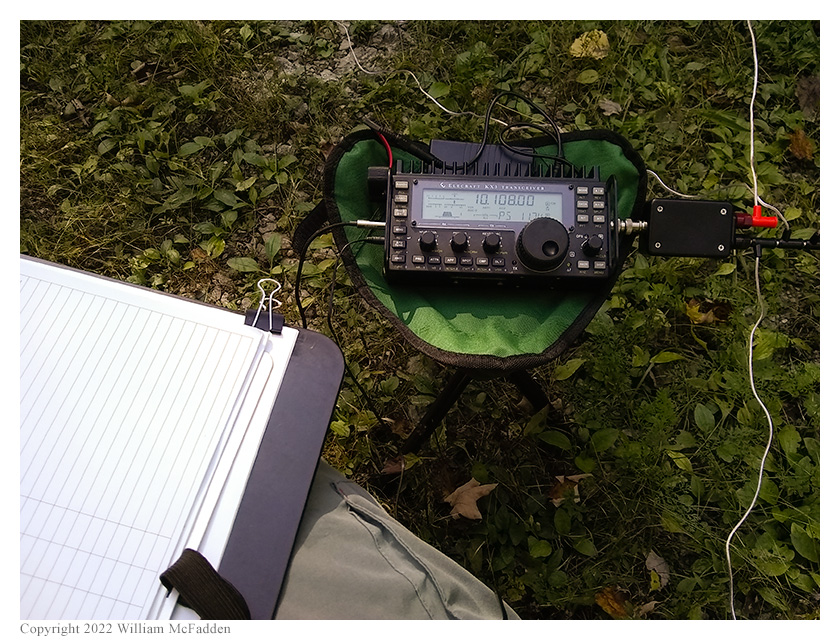
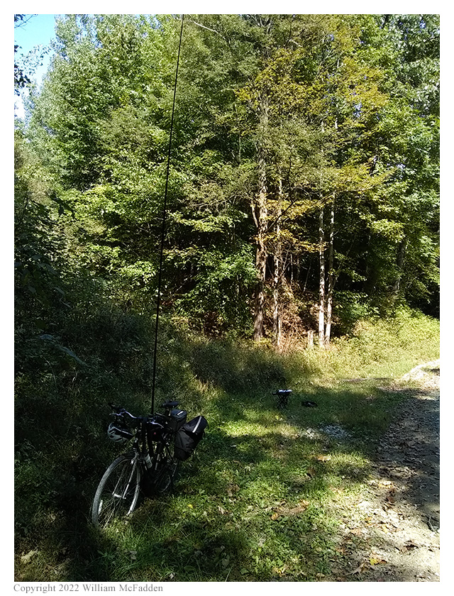
As usual, Eric was to ride his 1997-vintage steel GT Arette and would carry his KX3 Mini Travel Kit,
his Goture Red Fox Super Hard 720 carbon-fiber mast, and two small stools. (Eric estimates he has ridden over 30,000
miles on this bicycle since he purchased it in 1998.) Paul was to ride his lovely blue, fat-tired, Surly Krampus equipped with
a suspension-fork and hydraulic disc brakes, and he would carry his Icom IC-705 and a SOTABeams Band Hopper IV four-band dipole system.
Eric and Paul started their ride on the Moonville Rail Trail just after 10am, with an outside temperature measuring about 59°, and soon encountered
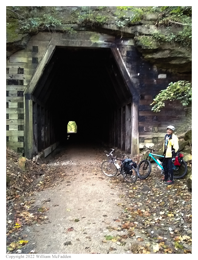
the first landmark of the ride: the 120' long, timber-lined King's Hollow Tunnel.
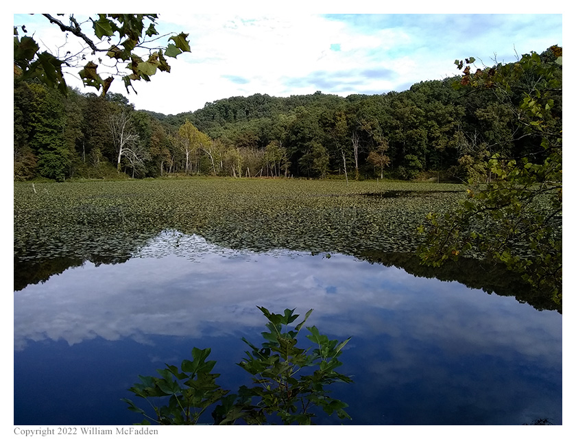
Riding through the very dark tunnel and continuing west on the Moonville Rail Trail, Eric and Paul soon came to the
pond at Bear Hollow but, alas, the pair of nesting Bald Eagles were not to seen on this occasion.
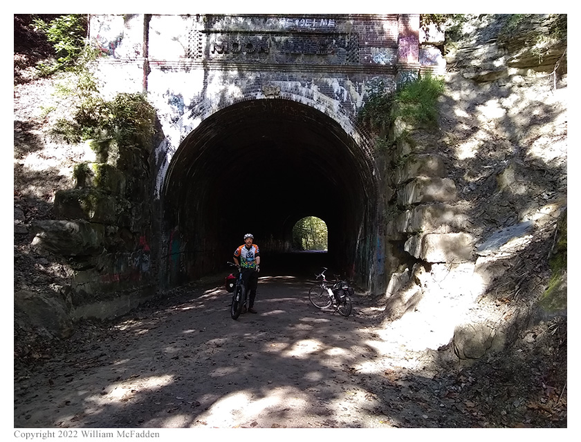
Continuing west on the smooth rail trail, and now well inside the Zaleski State Forest, Eric and Paul came upon the
brick-lined Moonville Tunnel (info).
After passing through Moonville Tunnel, Eric and Paul were forced to divert from the Moonville Rail Trail and follow the gravel
forestry road before re-joining the Moonville Rail Trail about a mile further on. (When CSX abondoned the rail line, they
took everything: rails, ties, ballast, and complete bridges. Two bridges west of Moonville Tunnel on the Moonville
Rail Trail have yet to be re-installed, and the cost to do so might mean they never get installed.)
As the Eric and Paul neared Lake Hope State Park, they left the Moonville Rail Trail and rode a short distance on
Wheelabout Road to the historic Hope Schoolhouse (info)
to take advantage of the available facilities and to shed layers, the outside temperature having by now risen well into the 60s.
Leaving Hope Schoolhouse, and continuing on paved roads, Eric and Paul rode the short distance to the entrance to
Lake Hope State Park and climbed up the long hill toward Keeton Cemetery. As they rode, the decided to continue past
Keeton Cemetery and to perform their two-fer activations of Lake Hope State Park and Zaleski State Forest, not at
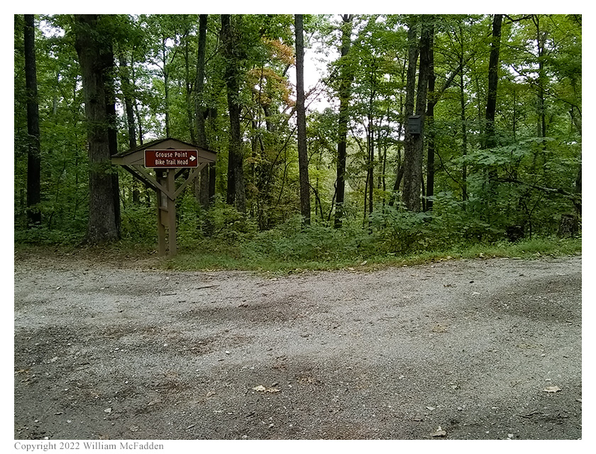
Keeton Cemetery, but at Grouse Point Trailhead on Cabin Ridge. At about 1525 UTC, shortly after the paved road turned to
smooth gravel, the pair arrived at Grouse Point Trailhead and found it to be empty and well suited for their POTA
two-fer activations of Lake Hope State Park and Zaleski State Forest.
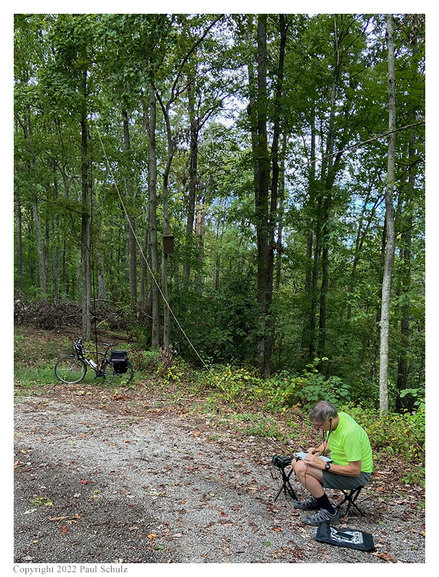
Grouse Point Trailhead has a single picnic table and Paul—having not brought a chair—chose this as his
operating location, quickly hanging his SOTABeams Band Hopper IV dipole from a conveniently located tree branch
and deploying his ICOM IC-705 on the picnic table.
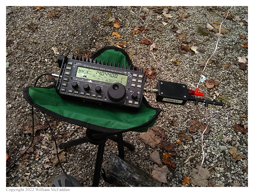
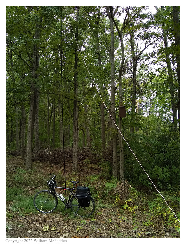
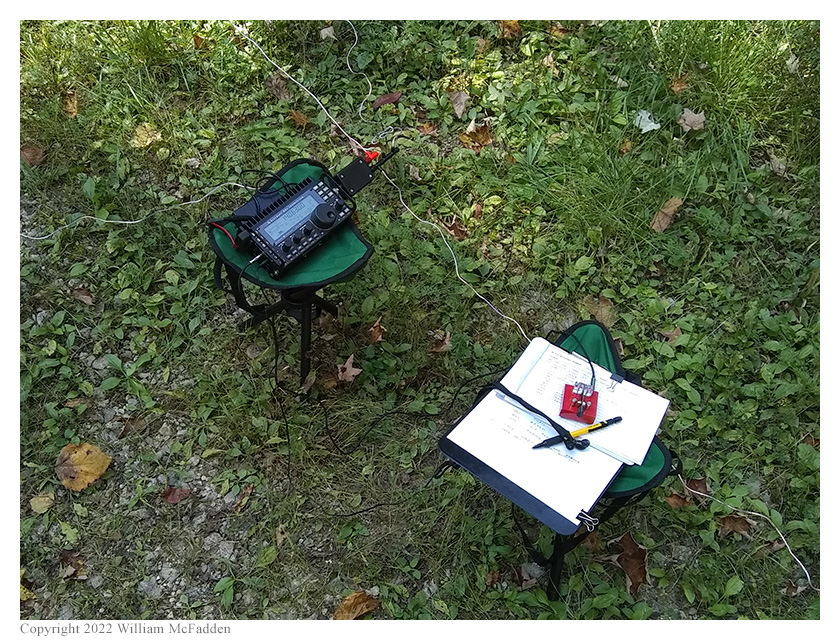
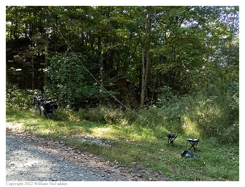
Choosing a location away from Paul, Eric deployed his 28½' wire antenna as a sloper with the top of the wire
supported on his Goture Red Fox Super Hard 720 carbon-fiber mast securely bungeed to his bicycle. Eric
deployed his KX3 on one of this two small stools and sat on the second stool during his activation. Eric and Paul
were both on the air at about 1537 UTC.
As Paul had anticipated, Grouse Point Trail Head had very good cell signal, so Eric and Paul were able to spot themselves to
POTA Spots (link) and to use POTA Spots to check for park-to-park (P2P) QSO opportunities.
Paul began his operation on 40m and operated using SSB, logging to an iPad. Paul quickly made the ten QSOs required to validate
his activations and then made a few extra QSOs, finishing with seventeen QSOs in the log.
In order to minimize mutual interference with Paul's station, Eric began his operations on 30m. Finding himself a frequency to run,
he spotted himself on POTA Spots and began calling "CQ POTA". Eric's first QSO came at 1540 UTC with WA4RCW in Tennessee. QSOs
came steadily, with Eric's tenth QSO coming at 1556 UTC with AA4TB in South Carolina. This run included QSOs with operators
located in Tennessee, North Carolina (3), Mississippi, Illinois (2), Virginia, Quebec, and South Carolina.
When 40m seemed to dry up, Eric switched to 20m, pleased to find little mutual interference between his station and Paul's,
spotted himself, and began calling CQ. His first QSO on 20m came at 1605 UTC with N5GW in Mississippi. This was followed by
a QSO at 1606 UTC with WB3DSJ in Florida.
Eric finished his operation by checking POTA Spots for P2P opportunities and at 1610 UTC he made a P2P QSO on 20m with KD8IE
who was activating Skyway Fishing Pier State Park (K-1916) in Florida. This was Eric's thirteenth and final QSO.
All of Eric's QSOs were CW and were made at 5w output.
Having previously experienced RF on his key when deploying with the KX3 Mini Travel Kit, Eric had, as an experiment, brought a
4:1 unun instead of the 4:1 balun that's normally a part of the KX3 Mini Travel Kit. During this activation, Eric found no
RF on his key whatsoever, an indication that an unun is, perhaps, the preferred device to use with this antenna.
After station tear-down, Paul and Eric enjoyed a quick picnic lunch, packed up their bicycles, and began their
ride to Turkey Ridge Wildlife Area.
After descending the long hill back to the Lake Hope State Park entrance, Paul and Eric turned south on SR278,
rode about 1½ miles to the base of Bolster Hollow Road, and rode about a mile up this gravel road to
the point where Bolster Hollow Road enters Turkey Ridge Wildlife Area. Having driven this road in a car many times,
but having never previously bicycled it, Eric found the climb to be longer and steeper than he had anticipated,
but the climb turned out to be not very bad. However, the road itself, following its use as a special stage in the
2022 running of the Southern Ohio Forest Rally (info), had
been re-graded with a combination of very fine sand and very large gravel, making stability on the climb a
challenge for Eric on his relatively narrow 38C tires.
Paul and Eric arrived at the hairpin-turn within Turkey Ridge Wildlife Area at about 1720 UTC. Paul surveyed the
two possible operating locations and, because of superior antenna-support trees, chose to set up at the hairpin
itself, leaving Eric the wide spot slighly uphill from the hairpin for his operation.
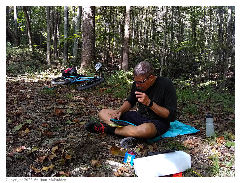
Paul and Eric quickly deployed their stations, Paul hanging his SOTABeams dipole from a convenient branch and
setting up his IC-705 on a towel on the ground. Eric again deployed his 28½' wire antenna as a sloper
with the top of the wire supported on his Goture Red Fox Super Hard 720 carbon-fiber mast bungeed to his
bicycle, and again deployed his KX3 on one of this two small stools. Paul and Eric were on the air about 1733 UTC.
Only minimal cell-signal was available at this location within Turkey Ridge Wildlife Area, with Eric having just
enough signal to send and receive text messages. Without access to POTA Spots, Paul was able to use his IC-705's
bandscope to find POTA activators to work as P2P QSOs and finally managed to get someone to spot him to POTA Spots,
enabling him to finish his activation relatively quickly with fourteen QSOs. This was Paul's first activation of
Turkey Ridge Wildlife Area.
With Paul beginning his operation on 40m, Eric began his operation on 30m, texting his frequency to his buddies
K8RAT and K4SWL and asking for them to spot him to POTA Spots. K8RAT was available to spot him and Eric's first QSO
came at 1736 UTC with K9ABR in Illinois. QSOs came steadily, if not quickly, and his fourth QSO came at 1743 UTC with
K4NAN in Tennessee. This run included QSOs with operators located in Illinois (2), Florida, and Tennessee.
With 30m seemingly dried-up, Eric changed to 20m, hoping that doing so wouldn't result in mutual interference
between his station and Paul's. Finding a frequency to run, Eric texted the frequency to K8RAT and K4SWL, and
began to call CQ. Eric's first QSO on 20m came at 1754 UTC and was a P2P QSO with KJ7DT who was activating
Farewell Bend State Recreation Area (K-9147) in Oregon. QSOs came steadily, with Eric's ninth QSO on 20m coming
at 1806 UTC with WB0MQA in South Dakota. This run included QSOs with stations location in Oregon, Texas, Kansas,
Florida, Minnesota, Montana, Nova Scotia, Georgia, and South Dakota. Eric finished his operation with thirteen QSOs.
All of Eric's QSOs were CW and were made at 5w output.
As at the Lake Hope / Zaleski two-fer activation earlier in the day, Eric experienced no RF on his key while
using the 4:1 unun between his KX3 and 28½' wire, further proof that he needs to build a 4:1 unun to keep
permanently in the KX3 Mini Travel Kit. Additionally, the Talentcell 12v 3000mAh LiPO battery easily powered the
KX3 through the two operations, an indication that this small and lightweight battery is a good choice to carry
in the KX3 Mini Travel Kit.
After tearing down their stations and re-packing their bicycles, Paul and Eric decided to continue the climb up Bolster Hollow
Road instead of descending back down the way they had come. Climbing to the top of the ridge, they came upon the intersection
of Bolster Hollow Road and Coalmont Hollow Road—the location where Eric and his son Miles had worked as radio operators
during the 2022 running of the Southern Ohio Forest Rally—and turned onto left onto Coalmont Hollow to descend back to
SR278. (In climbing Bolster Hollow and descending on Coalmont Hollow, Eric and Paul were bicycling the entire length of the Southern
Ohio Forest Rally Bolster Hollow special stage, albeit at a much slower pace than the powerful rally cars had
run through the stage.) Turning left onto SR278, they biked about a 1½ miles to a Moonville Rail Trail trailhead.
Turning left at the trailhead, Paul and Eric followed the Moonville Rail Trail east back to Mineral.
Upon their arrival back at Mineral, Eric and Paul had ridden twenty-six miles, mostly on gravel, while climbing 1,583'.
While this sort of riding is old-hat to Paul, Eric was pleased to find it hadn't been as challenging as he had
anticipated it would be and looks forward to doing more of this sort of thing.
View the map:
(return)
Attribution: "Bike Your Park Day" patch copyright Adventure Cycling Association.


