
by William Eric McFadden
From the Wayne National Forest website:
-
The Wayne National Forest is a patchwork of public land that covers over a quarter million acres of Appalachian foothills of southeastern Ohio. The Forest is divided into three units managed out of two Ranger District offices located in Nelsonville and Ironton, with a field office in Marietta.
The Forest features over 300 miles of trails for hiking, all-terrain vehicle riding, mountain biking, or horseback riding in season. The trails are open to ATVs, mountain bikes, and horseback riders from mid-April to mid-December each year. Come visit the Wayne and hike or ride our trails!
From the North Country National Scenic Trail website:
-
Come to the North Country. Trek the hills and valleys. Stand on the shores of lakes & streams from glaciers 10,000 years before. Clear-flowing water, red/gold of autumn, a fairyland of snow, open prairies, and distant horizons paint the land. Historic sites along the way tell how America settled and grew as a nation. From North Dakota to New York (and soon Vermont), adventure is never far away.
Pictures
Description
 On Saturday, February 13, 2021, one member of the Southeast Ohio Radio Adventure Team
performed a successful two-fer activation of Wayne National Forest and North Country National Scenic Trail in Ohio as
part of the Parks on the Air (POTA; link).
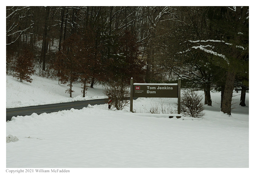
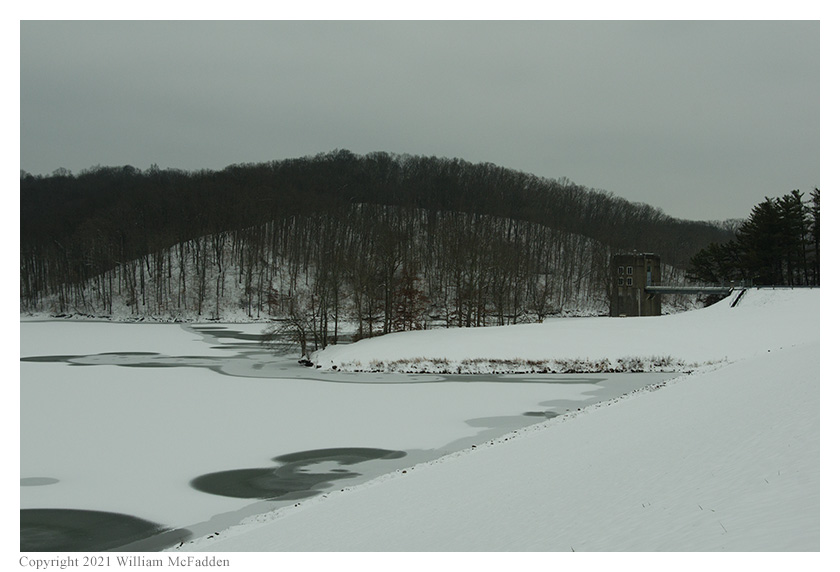
Eric McFadden, WD8RIF, performed the activation at Tom Jenkins Dam on a cold, overcast day and was
accompanied by his little dog, Theo.
On Saturday, February 13, 2021, one member of the Southeast Ohio Radio Adventure Team
performed a successful two-fer activation of Wayne National Forest and North Country National Scenic Trail in Ohio as
part of the Parks on the Air (POTA; link).
Eric McFadden, WD8RIF, performed the activation at Tom Jenkins Dam on a cold, overcast day and was
accompanied by his little dog, Theo.
Eric and Theo arrived at Tom Jenkins dam at about 1930 UTC to find the area only lightly populated. Eric parked his car at the far end of the parking lot and quickly deployed his 28½' wire vertical on his Jackite 31' telescoping fiberglass mast which he supported on the drive-on mount. Because of the low temparture, Eric chose to set up his KX3 inside the car. Eric was on the air at 1947 UTC.
As at previous visits to this location, Eric found he had good cell-signal and he was able to spot himself on the POTA Spots website and to use POTA Spots to identify possible Park-to-Park (P2P) QSOs.
 Beginning operations on 80m, Eric's first QSO came at 1952 UTC with his friend K8RAT in central Ohio. This QSO was followed in
quick succession with QSOs with K9IS in Wisconsin, VE3LDT in Ontario, and WC0Y in Indiana.
Beginning operations on 80m, Eric's first QSO came at 1952 UTC with his friend K8RAT in central Ohio. This QSO was followed in
quick succession with QSOs with K9IS in Wisconsin, VE3LDT in Ontario, and WC0Y in Indiana.
Switching to 40m, Eric's first QSO there came at 2000 UTC with his friend K4SWL in western North Carolina. QSOs came rapidly, with Eric's twenty-ninth QSO on 40m coming at 2029 UTC with K2EKM in Virginia.
After his good run on 40m, Eric took the opportunity to check the POTA Spots website for possible P2P QSOs. At 2031 UTC, Eric made a P2P QSO on 40m with KU8T who was performing an activation of Lost Bridge on Salamonie Lake State Recreation Area (K-4178) in Indiana. At 2035 UTC, Eric made a P2P QSO with K4NYM who was performing an activation of Tenoroc Wildlife Area (K-6327) in Florida. Finally, at 2039 UTC, Eric made a P2P QSO with NQ1F who was performing an activation of Sapowet Marsh State Wildlife Area (K-8293) in Rhode Island.
In all, Eric made thirty-six QSOs, which included three P2P QSOs. All of Eric's QSOs were CW and were made at the 5-watt level.
Eric also submitted his log to the World Wide Flora and Fauna in Amateur Radio (WWFF; link) program for an operation at North Country National Scenic Trail, KFF-5030.
(return)