
by William Eric McFadden
From the Tu-Endie-Wei State Park website:
-
Located on four acres in Point Pleasant, West Virginia, Tu-Endie-Wei State Park is home to an 84-foot granite monument commemorating the frontiersmen who fought and died in the 1774 Battle of Point Pleasant. The monument was erected in 1909, and rests where the Kanawha and Ohio Rivers meet. The name "Tu-Endie-Wei" is a Wyandotte word meaning "point between two waters".
From the Lewis and Clark National Historic Trail website:
-
The Lewis and Clark National Historic Trail is approximately 4,900 miles long, extending from Pittsburgh, Pennsylvania, to the mouth of the Columbia River, near present day Astoria, Oregon. It follows the historic outbound and inbound routes of the Lewis and Clark Expedition as well as the preparatory section from Pittsburgh, Pennsylvania to Wood River, Illinois.
Pictures
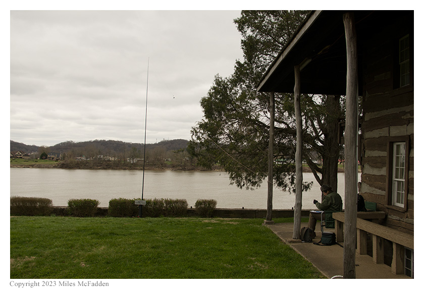
- Eric operates in the shelter of the Mansion House porch; photo by Miles McFadden
Description
 On Saturday, March 11, 2023, two members of the Southeast Ohio Radio Adventure Team
performed successful simultaneous activations of Tu-Endie-Wei State Park and Lewis and Clark National Historic
Trail in West Virginia as part of the Parks on the Air (POTA; link)
program.
On Saturday, March 11, 2023, two members of the Southeast Ohio Radio Adventure Team
performed successful simultaneous activations of Tu-Endie-Wei State Park and Lewis and Clark National Historic
Trail in West Virginia as part of the Parks on the Air (POTA; link)
program.
Eric McFadden, WD8RIF, and Miles McFadden, KD8KNC, visited Tu-Endie-Wei State Park on a cold, windy, overcast day to perform the simultaneous activations of Tu-Endie-Wei State Park and Lewis and Clark National Historic Trail at the confluence of the Ohio and Kanawha Rivers following a visit to Bidwell, Ohio, for the MOVARC Hamfest. Eric and Miles were accompanied by little dog Theo.
Eric, Miles, and Theo arrived at the park at about 1800 UTC. After walking Theo and considering places to set up his station, Eric decided to use the still-closed-for-the-season Mansion House Museum as shelter from the wind and operate under the porch roof on the southern side of the building. He and Miles strapped the 31' Jackite telescoping mast to an existing sign-post and deployed the 28½' wire antenna as a sloper up to the top of the mast. Eric set up his Elecraft KX3 on his folding camp-chair an was on the air at 1816 UTC.
As he had expected, Eric found he had excellent cell-signal and was able to self-spot himself on the POTA Spots website and to look for park-to-park (P2P) QSO opportunities.
Eric began operations by looking on POTA Spots for P2P QSO opportunities and at 1817 UTC he made a P2P QSO on 20m with VE3DN who was activating Diefenbunker National Historic Site (VE-5083) in Ontario. (Eric would very much like to visit the Diefenbunker National Historic Site himself for a tour and POTA activaiton.)
After finding his own frequency on 20m to run, Eric began calling "CQ POTA" and quickly noticed that the RBN-driven auto-spotting feature on POTA Spots wasn't functioning. After spotting himself, Eric's first QSO in this run came at 1823 UTC with WJ0L in Minnesota. QSOs came slowly, with Eric's ninth QSO in this run coming twenty-two minutes later at 1845 UTC with W4VHH in North Carolina. This run included QSOs with stations located in Minnesota, Tennessee, Illinois (2), Georgia, Mississippi, Missouri, Ohio, and North Carolina.
Eric completed his activation by again checking POTA Spots for P2P QSO opportunities, and at 1857 UTC he made a P2P QSO on 20m with KC3RW who was activating Harpers Ferry National Historic Park in Maryland, Virginia, or West Virginia.
Eric had hoped to have received his Elecraft AX1 portable antenna in time for this activation but, alas, the antenna hadn't arrived in time. In retrospect, he realized it was good that the antenna hadn't arrived in time because the combination of poor propagation and the lack of automatic spot-updating might have soured Eric on the wee antenna.
In all, Eric made eleven QSOs with two P2P QSOs in forty-one minutes. All of Eric's QSOs were CW and were made at the 5-watt level.
Miles did not operate but did all of the driving, helped with set-up and tear-down, did all of the activation photography, and tended to the needs of little dog Theo.
Eric also submitted his log to the World Wide Flora and Fauna in Amateur Radio (WWFF; link) program.
(return)