
by William Eric McFadden
The Roaring Waters of West Virginia RATpedition!
From the national park's website:
-
A rugged, whitewater river flowing northward through deep canyons, the New River is among the oldest rivers on the continent. The park encompasses over 70,000 acres of land along the New River, is rich in cultural and natural history, and offers an abundance of scenic and recreational opportunities.
Pictures
- At the Canyon Rim Visitor Center Overlook, looking down and left: the old bridge
- At the Canyon Rim Visitor Center Overlook, looking up and right, the new bridge: 1 | 2
- At the Canyon Rim Visitor Center: ascending the stair from the overlook
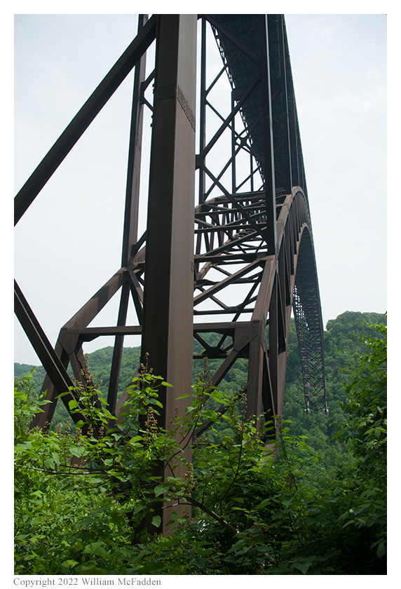
- Descending on the Fayette Auto Tour: The New River Gorge Bridge
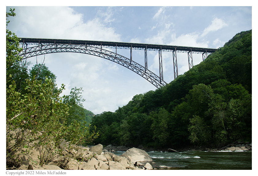
- At Fayette, at river-level, looking right: the old bridge; photo by Miles McFadden
- At Fayette, at river-level, looking left and up: the new bridge; photo by Miles McFadden
- At Fayette, Eric operating: 1 | 2 | 3; photos by Miles McFadden
- At Fayette, Thomas operating: 1 | 2; photo by Miles McFadden
- Ascending on the Fayette Auto Tour: The New River Gorge Bridge
- At Thurmond, WV: The historic Thurmond depot
- At Thurmond, WV: The railroad and auto bridge over the New River
- At Thurmond, WV: the New River roars under the bridge: 1 | 2 | 3
- At Thurmond, WV: the historic downtown
- At Thurmond, WV: the C&O coaling tower: 1 | 2 | 3
- On the road to Thurmond, a waterfall roars just below the C&O tracks: 1 | 2
- In Prince, WV: the 1946 C&O passenger depot, streetside-view
- In Prince, WV: the 1946 C&O passenger depot, trackside-view
- In Prince, WV: notice the vintage typeface
- In Prince, WV: notice the vintage C&O logo
- In Prince, WV: the town is still being served Amtrak
- In Prince, WV: Stretchers Neck Tunnel: 1 | 2
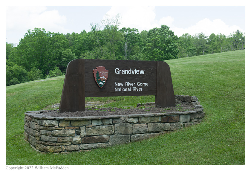
- At Grandview: The New River Gorge National Park sign at Grandview
- At Grandview: looking left | looking right; the sound of the roaring water clearly audible
- At Grandview: Eric operating; photo by Miles McFadden
- At Grandview: Thomas operating; photo by Miles McFadden
Description
 On Friday, May 20, 2022, and on Saturday, May 21, 2022, three members of the Southeast Ohio Radio Adventure Team
performed successful activations of New River Gorge National Park in West Virginia as part of the Parks on the
Air (POTA; link) program.
On Friday, May 20, 2022, and on Saturday, May 21, 2022, three members of the Southeast Ohio Radio Adventure Team
performed successful activations of New River Gorge National Park in West Virginia as part of the Parks on the
Air (POTA; link) program.
Instead of visiting southwestern Ohio for Hamvention, Eric McFadden, WD8RIF; Miles McFadden, KD8KNC; and Thomas Witherspoon, K4SWL, traveled from their homes in southeastern Ohio and western North Carolina to meet in West Virginia for The Roaring Waters of West Virginia RATpedition! which was to include three nights of tent-camping and four days of exploration and POTA activations. They were joined by Eric's small dog, Theo.
Friday, May 20: Canyon Rim Visitor Center and the New River Gorge Bridge
From the national park's New River Gorge Bridge website:
-
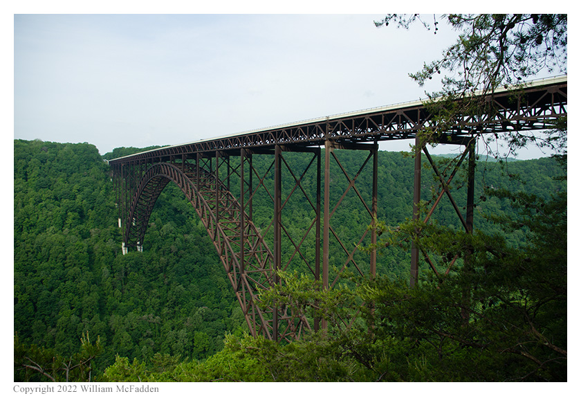
When the New River Gorge Bridge was completed on October 22, 1977, a travel challenge was solved. The bridge reduced a 40-minute drive down narrow mountain roads and across one of North America's oldest rivers to less than a minute. When it comes to road construction, mountains do pose a challenge. In the case of the New River Gorge Bridge, challenge was transformed into a work of structural art - the longest steel span in the western hemisphere and the third highest in the United States.
The team's exploration of New River Gorge National Park started at the Canyon Rim Visitor Center and the overlook beneath the spectacular New River Gorge Bridge.
At the Overlook: Looking to the left and down at the old bridge

At the Overlook: Looking to the right and up at the old bridge
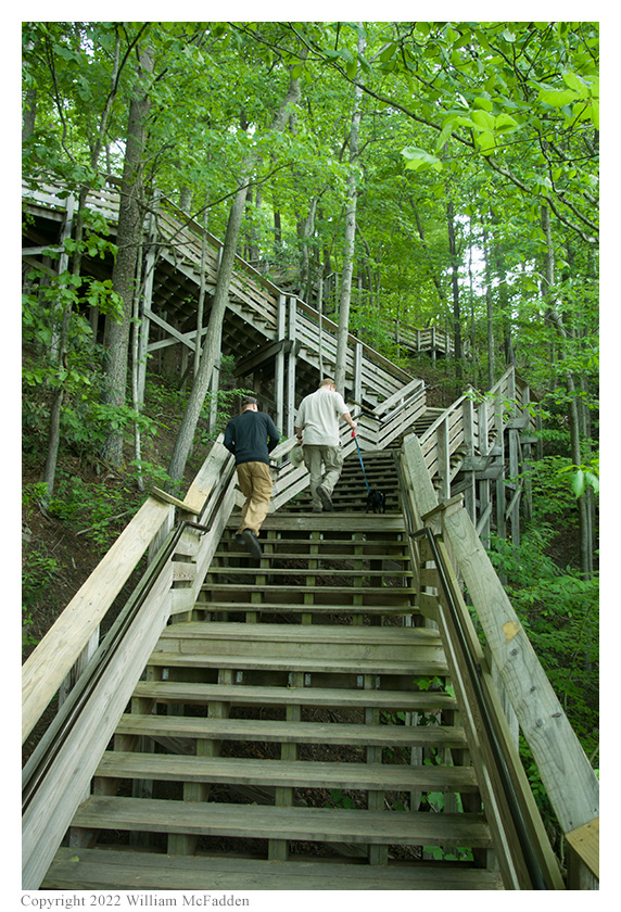
Miles and Thomas ascend the stairs from the
overlook back to the Canyon Rim Visitor Center
Friday, May 20: Fayette Station Road
From the national park's Fayette Station Road website:
-
Exploring Fayette Station Road is to travel back in time before the modern New River Gorge Bridge was built in 1977. This one hundred year-old road of hairpin turns winds down to the bottom of the gorge, across a narrow bridge, and up the other side. Visible along the way are vistas of the river and bridges, a hardwood forest, and remnants of the New River Gorge communities that once teemed with activity.
In 1873 the C&O Railway opened this rugged wilderness and carried coal out of the gorge to ports in Virginia and cities in the Midwest. By 1905, thirteen towns sprang up between Fayette Station Road and Thurmond 15 miles upstream, about one per mile. Between the 1870s and the 1950s, West Virginia coal contributed significantly to the industrialization of the United States as it fed the nation's trains, factories, and fleets.
At river level, Fayette Station Road runs directly through remnants of the townsites of Fayette and South Fayette. The establishment, growth, and ultimate demise of these two towns represent the general life cycle of a town in the gorge. A landowner or mining company opened a coal mine and built company-owned houses and a store, creating a company town. Decades later, when the coal seam was exhausted or the mine closed because of changes in the marketplace, people moved away and these towns were ultimately deserted.
Today, the New River Gorge is known for its outstanding natural and scenic beauty. The many remains of the once vibrant towns, mines, and homes that filled the gorge are now mostly hidden beneath layers of native vegetation. Along Fayette Station Road, however, some remnants of the area's coal mining and railroad heritage prevail.
The plan had been to perform the POTA activations of New River Gorge National Park at the National Park Service campground parking area just a small fraction of a mile from the Canyon Rim Visitor Center after having driven there the long way via the steep and very twisty Fayette Station Road and the old Tunney Hunsaker Bridge at Fayette Station.
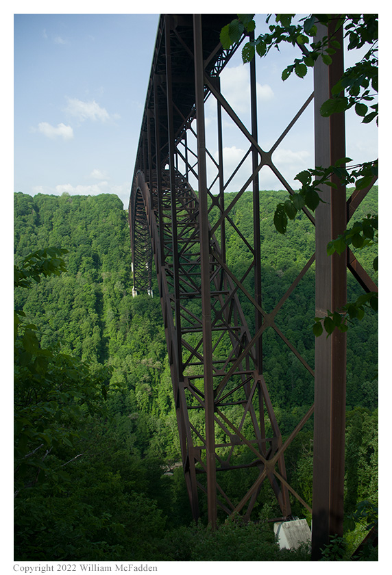
The New River Gorge Bridge, viewed
while descending Fayette Station Road
However, upon crossing the historic bridge and discovering the beauty of the New River Gorge at this location, discovering suitable operating locations within a stone's throw of the beautiful and noisy rapids on the New River at this location, and discovering that despite all expectations to the contrary, cell-signal was actually available at this location deep within the New River Gorge, the trio decided to perform their activations at the Fayette Road parking area near the Fayette Station Public River Access area.

At Fayette Station, looking toward the right at the
old Fayette Station Bridge; photo by Miles McFadden
At Fayette Station, looking toward the left and way up at
the New River Gorge Bridge; photo by Miles McFadden
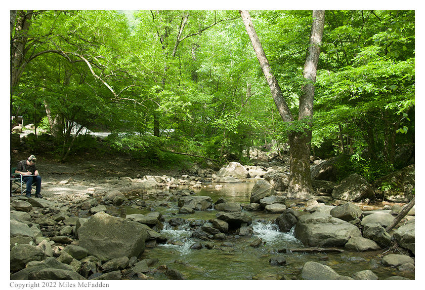
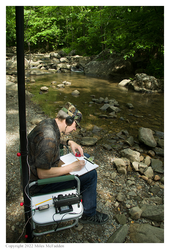
Thomas decided to set up his station on a beach-like area, at a small distance from the parking area. He threw a line through a tree, deployed an end-fed wire antenna, and was quickly making contacts.

Thomas (lower-right corner) operating;
photo by Miles McFadden

Thomas operating and recording video for his blog;
photo by Miles McFadden
Eric chose to set up his station on the rocks, engulfed in the roar of the water, as close to the rapids as he could get. He found a suitable spot, strapped his 31' Jackite telescoping fiberglass to his folding camp-chair, pulling his 28½' wire vertical up as he extended the mast, while Miles spread out the three 17' counterpoise wires. Placing his KX3 on the camp-chair's flip-up table and powering it with his Talentcell 12v 3000mAh lithium ion battery pack (link), Eric was on the air at 1427 UTC.
Eric started his operation on 40m by finding himself a frequency to run, calling CQ, and spotting himself to POTA Spots. His first QSO came at 1430 UTC with N8SCO in West Virginia. QSOs came steadily, with Eric's fifth QSO coming at 1438 UTC with W5GDW in North Carolina. This run included a park-to-park (P2P) QSO with WA3TMR who was activating Antietam National Battlefield (K-0700) in Maryland and QSOs with operators located in West Virginia, Tennessee (2), Maryland, and North Carolina.
Eric then checked POTA Spots and at 1444 UTC he made a P2P QSO on 17m with Thomas to ensure that both operators would get hunter- and P2P-credit for New River Gorge National Park. Seeing on POTA Spots that Thomas went to 20m soon after this QSO, Eric followed and at 1446 UTC he made a second P2P QSO with Thomas.
Finding himself a frequency to run on 30m, Eric's first QSO on that band came at 1448 UTC with N4RKK in Florida. This was followed at 1451 UTC by a QSO with NN9K in Illinois.
Spending just a few minutes on 20m, at 1458 UTC Eric completed a QSO with W5LD in Louisiana.
Eric completed his activation at 1502 UTC by making a third P2P QSO with Thomas, this time on 40m.
In all Eric made eleven QSOs, including four P2P QSOs. All of Eric's QSOs were CW and were made with five watts output.
Eric would also submit his log to the World Wide Flora and Fauna in Amateur Radio (WWFF; link) program.
UPDATE: Read the report (and watch the video) by Thomas about his experience at New River Gorge National Park: https://qrper.com/2022/07/new-river-gorge-pairing-the-tuftein-91-random-wire-with-the-elecraft-kx2/.
Miles did not operate but he helped with set-up and tear-down, he did much of the activation photography, and he kept Theo-dog safe.
Eric operating (lower-left corner); photo by Miles McFadden
Eric operating; photo by Miles McFadden

Eric operating; photo by Miles McFadden
As at the previous activations during this RATpedition, Thomas and Eric found that interference between their stations was minimized by operating on bands not harmonically related and by trying to establish distance between the stations.
After checking out the view from the Fayette Station Public River access, the trio plus Theo-dog climbed out of the New River Gorge by continuing to follow the steep and twisty Fayette Station Road.
The New River Gorge Bridge as viewed
on the Fayette Station Road climb
Saturday, May 21: Thurmond, WV
Saturday was to be a mostly sightseeing day, with further exploration of New River Gorge National Park with, perhaps, an activation of the park at the Grandview Visitor Center.
The first place to visit was Thurmond, WV and the Thurmond Depot Visitor Center.
From the national park's Thurmond website:
-
During the first two decades of the 1900s, Thurmond was a classic boomtown. With the huge amounts of coal brought in from area mines, it had the largest revenue on the Chesapeake & Ohio Railway. Having many coal barons among its patrons, Thurmond's banks were the richest in the state. Fifteen passenger trains a day came through town-its depot serving as many as 75,000 passengers a year. The town's stores and saloons did a remarkable business, and its hotels and boarding houses were constantly overflowing. With the advent of diesel locomotives, and less coal coming in from local mines, the town began a steady decline. The many businesses closed down, and most residents moved on.
Today, the town of Thurmond remains surprisingly untouched by modern development. It is a link to our past, and a town with many stories to tell. New River Gorge National River invites visitors to experience the impact of the industrial revolution, and the mission of the National Park Service to preserve our nation's heritage.
Unfortunately, the Thurmond Depot Visitor Center was not yet open for the season, but this didn't diminish the beauty of the historic town nestled deep in the gorge, the depot, the old coaling tower, or the bridge spanning the New River. Nor did it pleasure inherent in listening to the symphony produced by the New River's rapids at this point.
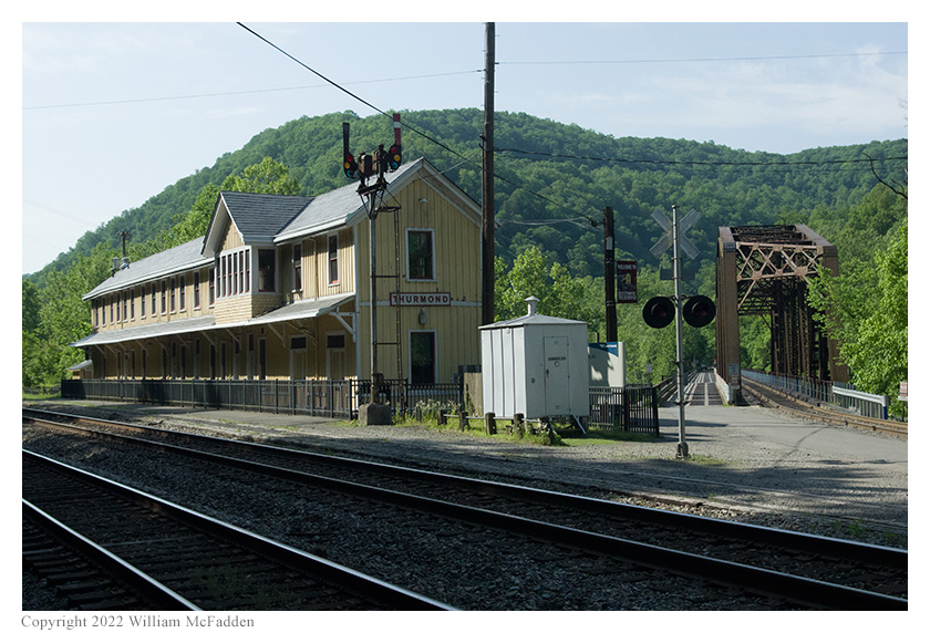
The historic Thurmond Depot
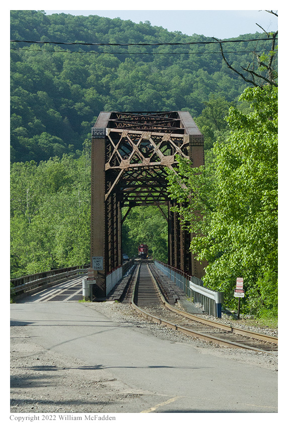
The railroad and narrow automobile bridge spanning the New River.

The narrow automobile bridge spanning the New River.
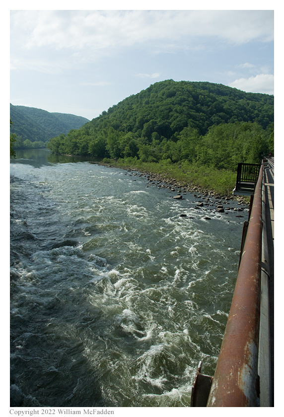

The New River roars under the bridge
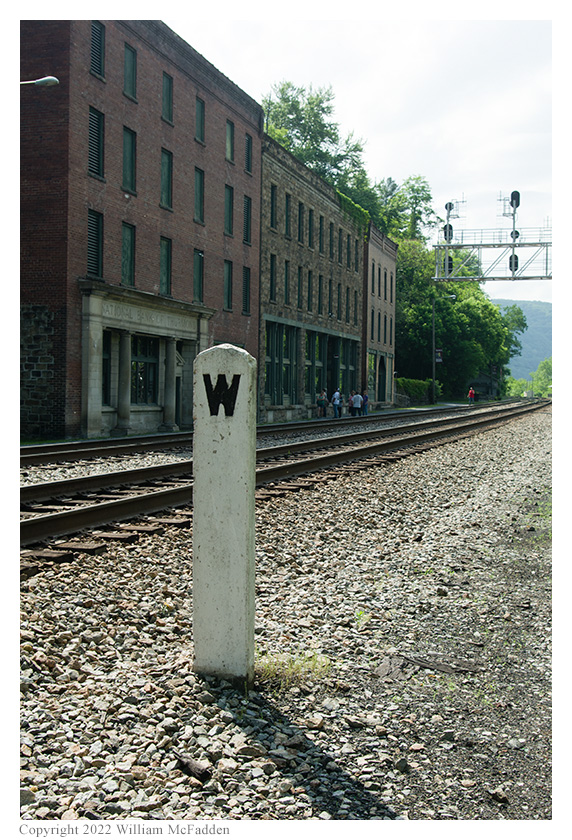
Historic downtown Thurmond
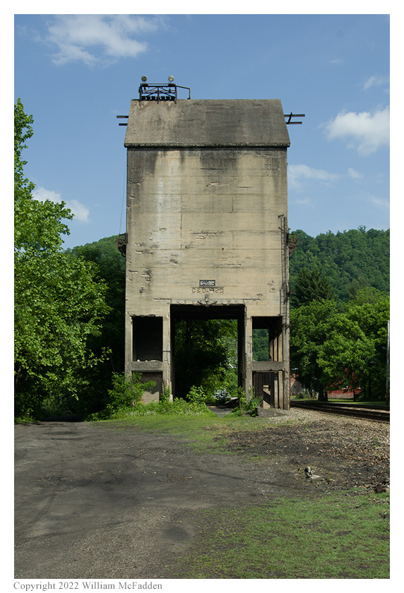
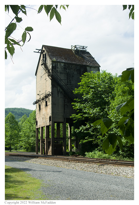
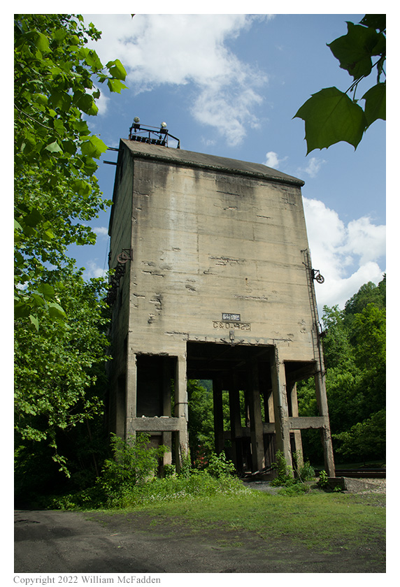
The C&O coaling tower
Saturday, May 21: On the road from Thurmond, WV
Leaving Thurmond, the trio found a beautiful waterfall and rapids on Dunlop Creek, just below the C&O right-of-way.
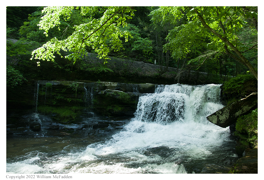
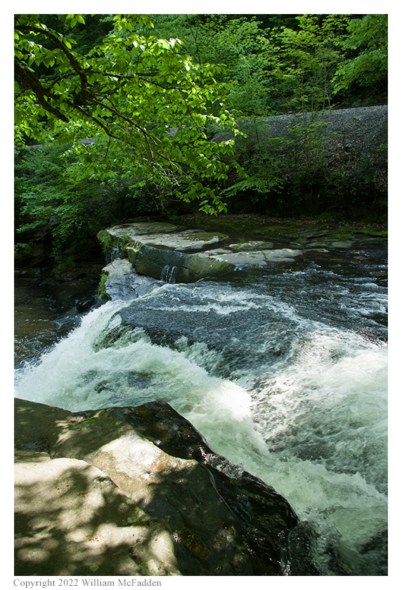
A noisy little waterfall on Dunlop Creek
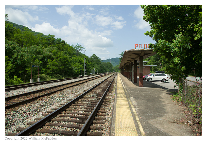
Saturday, May 21: Prince, WV
Next on the itinerary was a visit to Prince, WV to see the 1946 C&O railroad station and Stretchers Neck Tunnel.
From the national park's Prince, WV website:
-
The town of Prince was formed in 1870, when brothers William and James Prince purchased 300 acres along the New River from General Alfred Beckley. They arrived prior to the building of the Chesapeake and Ohio Railroad in 1873 and established a mercantile store and ferry crossing. Their businesses flourished during the construction of the railroad, the Stretcher's Neck tunnel, and a bridge across the New River. Prince itself was not a mining town, however, the advantageous geographical location made it possible to supply mining towns on Laurel Creek and Layland in Fayette County, and on Piney Creek and Beckley in Raleigh County.
The brothers built their home at the junction of the Piney Creek line and the main line. As part of the right-of-way agreement the brothers sold to the C & O Railroad, all through trains stopped at Prince, making it possible for the store to offer a wide variety of goods.
The first Prince passenger train depot was built in 1880 and lasted until 1917. It was destroyed by fire, and then rebuilt that same year. The current train depot was built in 1946 by C&O Railroad.
All town lands and businesses were owned by the Prince family, and were rented out and not sold. At one time the town had 250 residents with a elementary and high school, two churches, post office, train depot, hotel and a tavern.
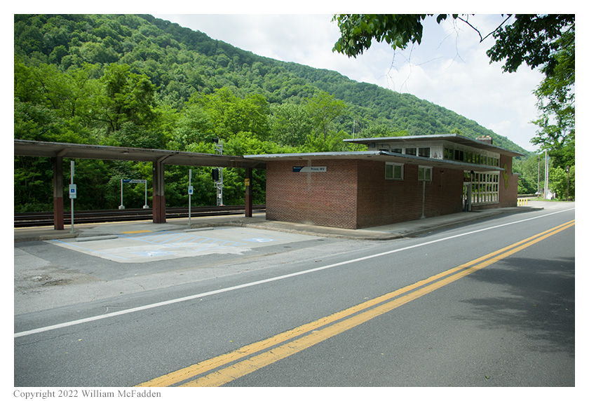
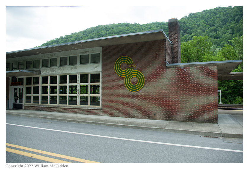
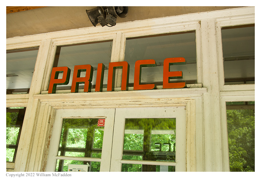
The 1946 C&O station. Notice the vintage C&O symbol and the art-deco typeface.
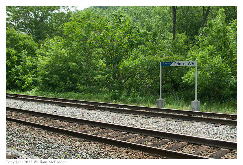
Prince, WV is still served by Amtrak

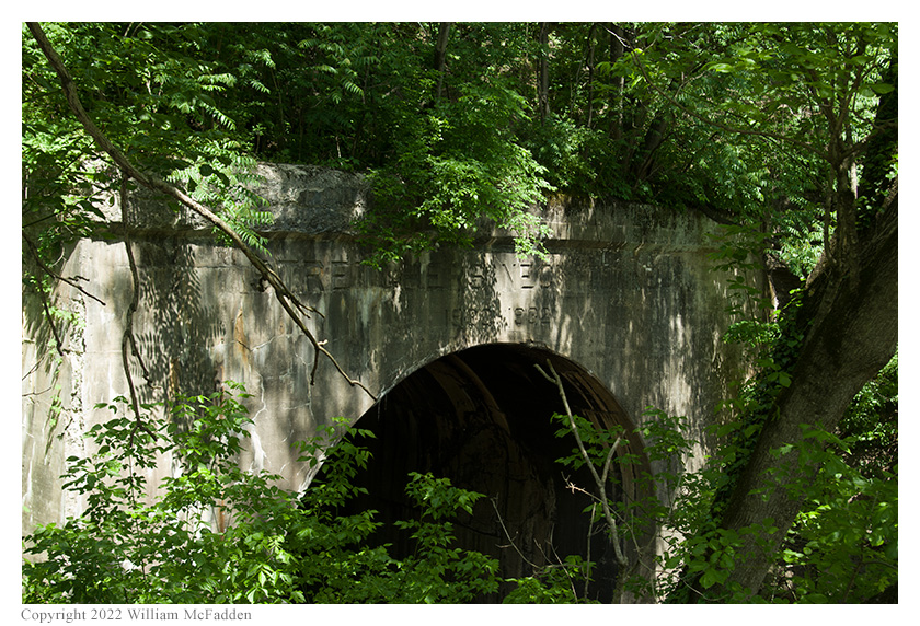
Stretchers Neck Tunnel
Saturday, May 21: Grandview
The final stop in this exploration of New River Gorge State Park was at Grandview Visitor Center to take in the view and to perform a second set of POTA activations of New River Gorge National Park.
From the national park's Grandview Visitor Center website:
-
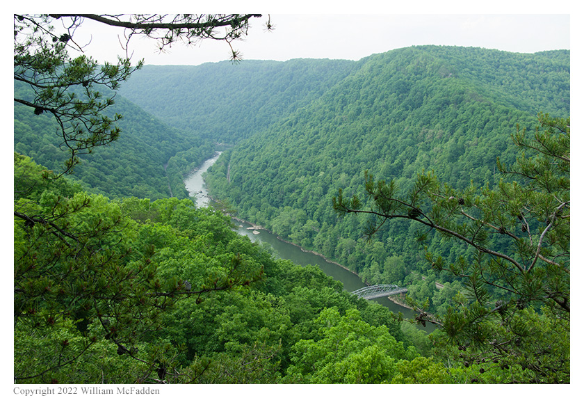
Grandview Visitor Center is located in the Grandview section of the park at the highest elevation in the park and perched along the edge of the gorge where visitors will find a stunning view looking nearly 1,400 feet down from the rim to the river.
The New River Gorge National Park sign at Grandview
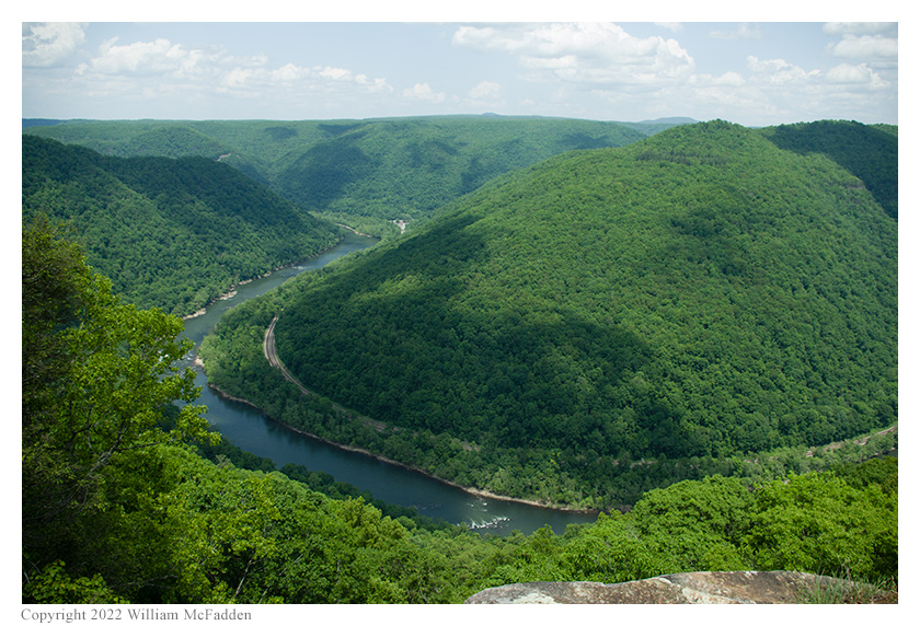
Looking left at the overlook
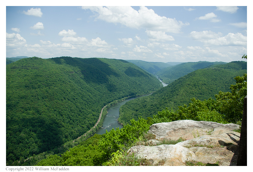
Looking right at the overlook; the sound of the rapids
far below was clearly audible at the overlook
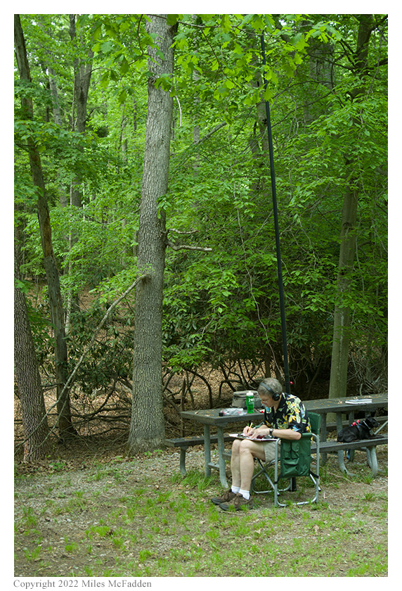
After some exploring, a rustic picnic area was found for the POTA activations. Thomas chose one picnic table and deployed his Chameleon Antenna CHA MPAS Lite antenna and Elecraft KX2 and was on the air in short order.
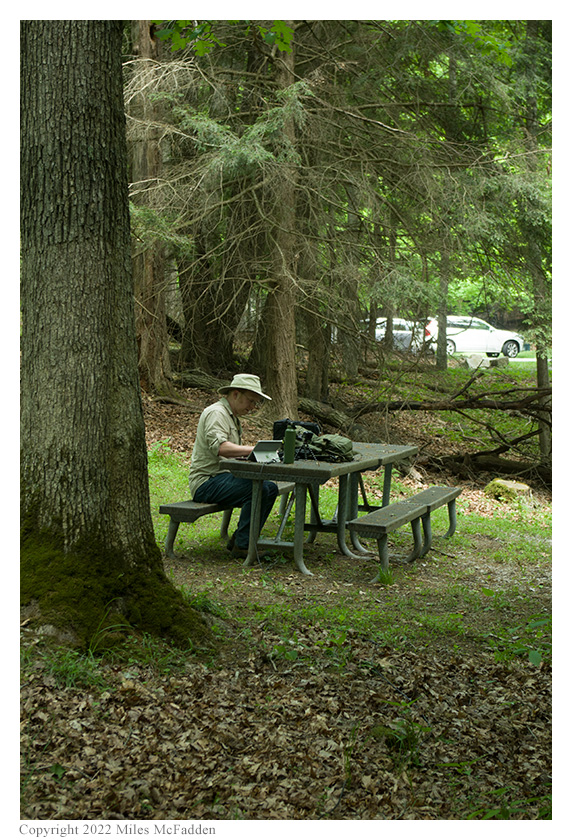
Eric selected a picnic table at a distance from Thomas and chose to again strap his 31' Jackite telescoping fiberglass mast to his folding camp-chair. Pulling his 28½' wire vertical up as he extended the mast, laying out the three 17' counterpoise wires, and placing his KX3 on the camp-chair's flip-up table, Eric was also on the air in short order.
Due to the high elevation—Grandview is the highest point within New River Gorge National Park—both Thomas and Eric had cell-signal and were able to use use POTA Spots for spotting themselves and to look for park-to-park (P2P) QSO opportunities.
Eric began operations on 40m and his first QSO came at 1850 UTC and was a P2P QSO with Thomas. QSOs came steadily on 40m, with Eric's ninth QSO coming at 1906 UTC with KN4WNI in North Carolina. This run included QSOs with operators located in West Virginia, New Jersey, Virginia (2), North Carolina (2), Michigan, and Ohio.
Pausing to check POTA Spots, at 1910 UTC Eric completed a second P2P QSO with Thomas, this time on 30m. For this QSO, Eric dialed his KX3 back to 100mW output power.
Returning to 40m, Eric completed two more QSOs. At 1912 UTC he made a QSO with W8EWH in Michigan and at 1913 UTC he made a QSO with KY4GS in South Carolina.
Switching to 20m to run a frequency, at 1917 UTC Eric completed a third P2P QSO with Thomas. This was followed at 1919 UTC by a QSO with K4NAN in Tennessee.
In all Eric made fourteen QSOs, including three P2P QSOs. All of Eric's QSOs were CW and were made with five watts output.
Eric would also submit his logs to the World Wide Flora and Fauna in Amateur Radio (WWFF; link) program.
Thomas's report will be available soon on his blog, QRPer.com.
Eric operating (left); Thomas operating (right); photos by Miles McFadden
Miles did not operate but he helped with set-up and tear-down, he did much of the activation photography, and he kept Theo-dog safe.
(return)