While Norfolk Southern's West Virginia Secondary doesn't have a large amount of traffic, it is the only remaining railroad passing through Athens County, Ohio.
Norfolk Southern's West Virginia Secondary extends from south of Charleston, West Virginia, to Buckeye Yard in Columbus, Ohio. The road crosses the Ohio River at Point Pleasant, West Virginia near Middleport, Ohio. Just south of Middleport is Hobson Yard, where crew changes take place and the helper locomotives are added to the rear of north-bound coal trains.
Much of the traffic on the West Virginia Seconday consists of coal from the West Virginia's Gauley River coal fields destined for the industrial regions in northern Ohio and Pennsylvania. A fair amount of traffic consists of chemical tank cars from the the chemical plants along the Kanawha River.
Prior to June 1, 1999, the West Virginia Secondary was part of the Conrail system. On January 1, 2000, the West Virginia Secondary became part of the NS Pocohontas Division. It is expected that dispatching will eventually be moved to Bluefield, WVa.
![]() The former-PRR line which runs between
Zanesville and New Lexington, Ohio has beeng rebuilt and reactivated by the Ohio
Southern Railroad with a $2 million grant and a $3.5 million loan from the Ohio
Rail Development Commission. This road interchanges with the West Virginia Secondary
in New Lexington. About a million tons of low-sulfur coal will move annually from a
new mine north of Glouster to American Electric Power's Conesville power plant in
Coshocton. The new mine is being operated by the Buckingham Coal Company and is now
operational. A conveyor belt carrie the coal across Ohio State Route 13 to the
railroad tracks, where it will be loaded into the rail cars.
The former-PRR line which runs between
Zanesville and New Lexington, Ohio has beeng rebuilt and reactivated by the Ohio
Southern Railroad with a $2 million grant and a $3.5 million loan from the Ohio
Rail Development Commission. This road interchanges with the West Virginia Secondary
in New Lexington. About a million tons of low-sulfur coal will move annually from a
new mine north of Glouster to American Electric Power's Conesville power plant in
Coshocton. The new mine is being operated by the Buckingham Coal Company and is now
operational. A conveyor belt carrie the coal across Ohio State Route 13 to the
railroad tracks, where it will be loaded into the rail cars.
A new forum, NSLakeDivisionRailfans was started in January '04 and is dedicated to discussions concerning Norfolk Southern Lake and Dearborn Divisions.
Trains Symbols, courtesy of Dan Innis:
-
NS Symbol NS Number Origination Destination Days of the Week Loads CODI 44N Columbus Dickinson Tuesday - Saturday tank car empties DICO 45N Dickinson Columbus Tuesday - Saturday tank cars NS600 600 Dickinson Ashtabula coal NS601 601 Ashtabula Dickinsen coal empties NS602 602 Dickinson Middletown coal NS603 603 Middletown Dickinson coal empties NS604 604 Dickinson Toledo coal NS605 605 Toledo Dickinson coal empties NS606 606 Dickinson Buffalo coal NS607 607 Buffalo Dickinson coal empties NS608 608 Dickinson Baltimore Terminal, MD coal NS609 609 Baltimore Terminal, MD Dickinson coal empties NS610 610 Dickinson Shamokin Dam, PA coal NS611 611 Shamokin Dam, PA Dickinson coal empties NS612 612 Dickinson Strawberry Ridge, PA coal NS613 613 Strawberry Ridge, PA Dickinson coal empties NS614 614 Dickinson New Haven, PA coal NS615 615 New Haven, PA Dickinson coal empties NS616 616 Dickinson Martins Creek, PA coal NS617 617 Martins Creek, PA Dickinson coal empties NS618 618 Dickinson Indian River, DE coal CORO 148 Columbus Roanoke daily ROCO 147 Roanoke Columbus daily NS608-617 are trains that originate at Dickinson and go south to Mullens or originate in Mullens and go north to Dickinson. NS618 operates over the Columbus & Ohio River between Columbus and Mingo Junction. CORO and ROCO haven't been seen yet on the Secondary.
A list of NS trains symbols and alpha designators is maintained by Chris Toth at http://www.ohio.net/~ctoth/alphagrps.html. Another list is maintained at Norfolk Southern Train Symbol List by Kevin Burkholder.
The NS locomotive roster is available at http://www.ole.net/~rcraig/NS.HTML, the NS portion of the Motive Power Roster.
Train Frequency
- Train schedules can be found at On Track On Line
Radio Frequencies
-
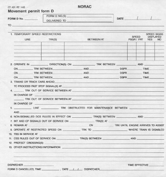
Road Road Freq. EOT MoW Conrail 161.070 457.9375 161.055 NS 161.115 Trains are controlled by use of the Movement Permit Form D.
Maps:
-
Armitage Siding, northeast of Athens, Ohio. The south end of the siding is at MP 82. To drive to the siding, follow Armitage Road off of SR 682. Please note that the wye depicted on this map is gone, and the former C&O right-of-way is now a bicycle path.
Maps Copyright 1997 GeoSystems Global Group
Hobson Yard, south of Middleport, Ohio. The tracks south of the Ohio River are CSX.
Maps Copyright 1997 GeoSystems Global Group
Crossing the Ohio River at Point Pleasant, West Virginia.
Maps Copyright 1997 GeoSystems Global Group
Glouster Detector
-
According to Mike Hansgen, the Glouster, Ohio detector is near the Tom Jenkins dam; it is 3.6 miles south of the junction of State Route 13 and State Route 155 in Corning. It is 1.0 mile north of the grade crossing of State Route 13 at the Tom Jenkins dam. The detector is just off Cornstill Road.
Mileages
-
MP City Facility Description 250 Zela, WV 247 JONES siding 246 Drennen, WV 245 LOCK 243 Lockwood, WV 240 PETERS JCT 238 Koontz, WV 234 Omega, WV 232 Swiss, WV SWISS siding 230 Beech Glen, WV 228 Belva, WV VAUGHN CONN TRK 223 Gauley Bridge, WV GAUL 221 Glen Ferris, WV 220 FERRIS 216 Alloy, WV 214 Harewood, WV 212 Cannelton, WV SMIT 208 Hugheston, WV 206 Midwest, WV 204 Glasgow, WV 203 Cedar Grove, WV 202 Monarch, WV 201 Shrewsbury, WV 200 DICK 199 Dickinson, WV DICKINSON Dickinson Yard 197 Witcher, WV MAX 196 Belle, WV 193 LEVI 191 Port Anherst, WV 189 Snow Hill, WV 186 Charleston, WV 182 STATE 178 Dunbar, WV 177 BAR 175 Institute, WV 170 NITRO siding 168 Putnam, WV 167 ROCK 163 Bancroft, WV 161 Courtney, WV 159 Red House 157 Eleanor, WV 155 Rumer, WV RUM 150 Buffalo, WV 147 Robertsburg, WV 143 Arbuckle, WV BUCK siding 140 Leon, WV 137 Beech Hill, WV 133 MATH 129 Point Pleasant, WV 126 Kanauga, WV CONCO 116 Hobson, OH KING Hobson Yard 115 WINE 110 Meigs, OH 108 Langsville, OH 104 DEXTER 103 Dexter, OH 97 Carpenter, OH 90 Albany, OH 81 Athens, OH 80 ARM siding 76 Chauncey, OH 73 Millfield, OH 69 Trimble, OH 67 Glouster, OH 60 Corning, OH 59 CORN siding 54 Moxahala, OH 52 CLAYBANK siding 48 New Lexington, OH 45 LACY 44 Junction City, OH 36 Bremen, OH 32 Rushville, OH 26 Pleasantville, OH 23 THURSTON siding 20 Baltimore, OH 11 Pickerington, OH 6 Brice, OH BRICE siding 3 Truro, OH 0 BANNON junction
Pictures:
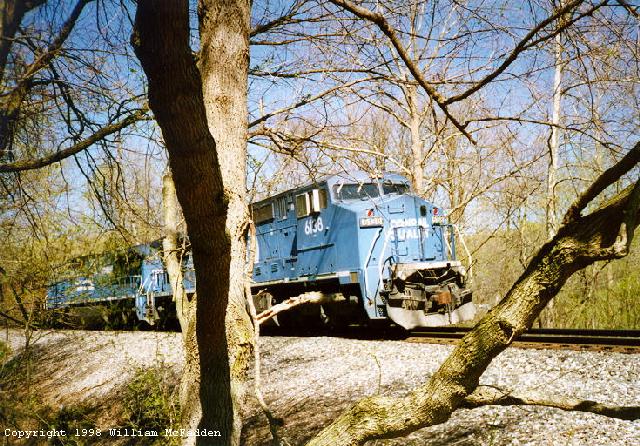
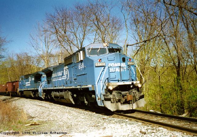
- C40-8W #6138 waiting to enter Armitage siding, 3:45pm Sunday April 5, 1998.
- C40-8W #6138 and C40-8W #6060 with empty coal hoppers approaching Armitage siding, 4pm Sunday April 5, 1998.
- SD40-2 #6489 and SD60I #5649 pulling empty coal coal hoppers just south of Armitage siding, 5pm Thursday April 2, 1998.
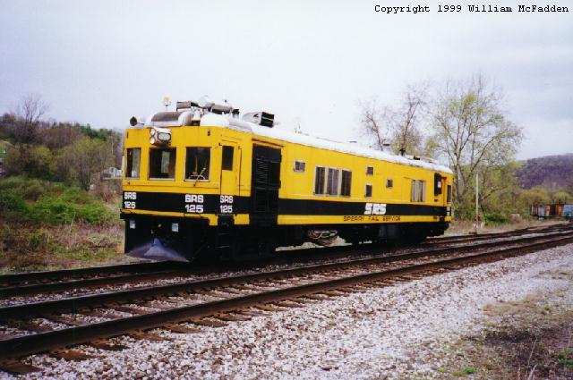
- Sperry Rail Inspection Car at Armitage siding.
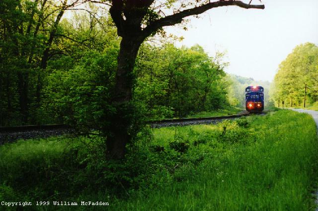
- Renumbered-for-NS C40-8W #8435 on the point of CODI along County Road 10 in Meigs County, Ohio, May 19, 1999.
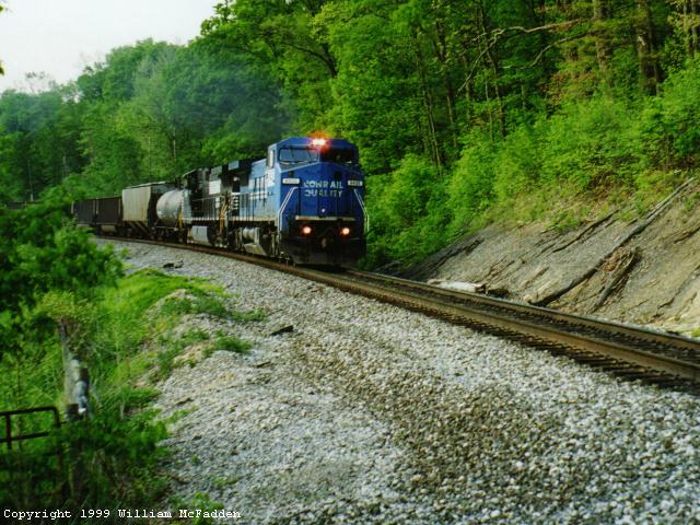
- #8435 and CODI crossing Township Road 3, further south in Meigs County, Ohio on May 19, 1999.
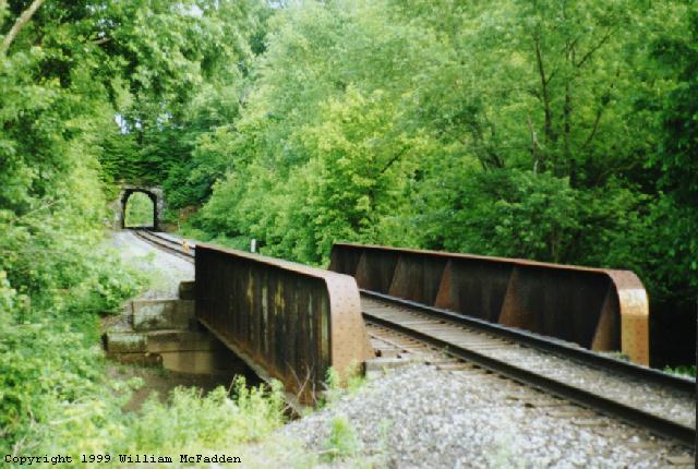
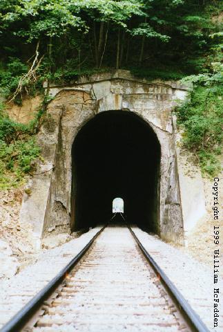
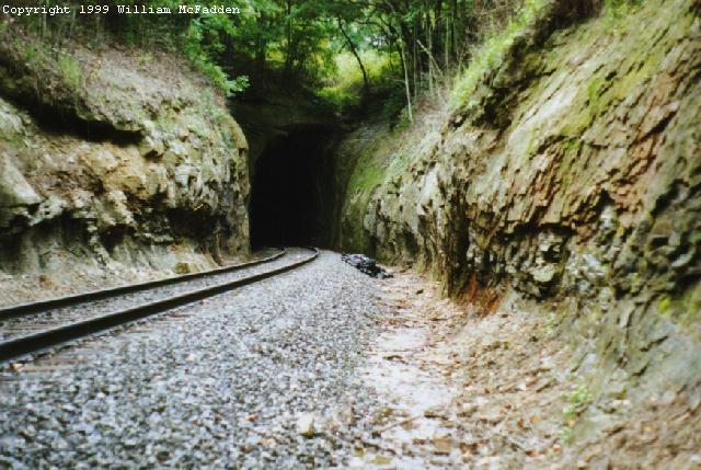
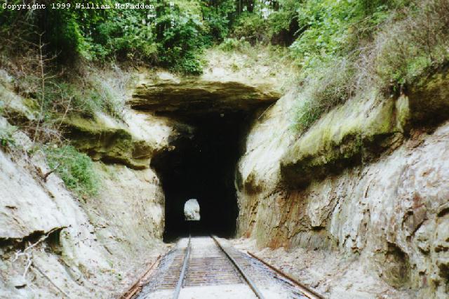
- A view of the tunnel at MP 102. Photo taken May 27, 1999.
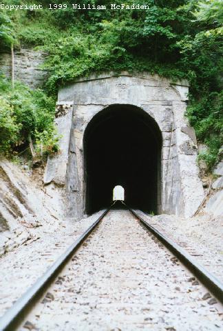
- One end and the other of the Lansgville Tunnel. Photo taken in June 1999.
- The north portal of the New Lexington tunnel on the NS West Virginia Secondary near New Lexington, Ohio.
- The south portal of the New Lexington tunnel on the NS West Virginia Secondary near New Lexington, Ohio.
Possible photography locations:
- The tunnel at milepoint 102 near the crossing of Township Road 27 north of Dexter, Ohio. This tunnel is a bore through living rock.
- Langsville tunnel in Meigs County, Ohio.
- The overlook just north of Dexter on County Road 4.
- Along County Road 10 south of Albany, Ohio.
Itinerant railfan Ed Lenio (Edward.Lenio@mci.com) says the West Virginia Secondary is his favorite road and is great for photography because the scenery is so nice. Ed suggests the following locations:
- Langsville tunnel, south portal. He doesn't know if CODI still leaves at 8:00am from Columbus, but if it does the sun should be on the train as it exits the tunnel.
- Dexter, Ohio; has small town quality. Conrail has a blue DEXTER sign north of town which, with the homes, could be framed with train as the train travels north.
- (Ohio) State Route 13 crossing near the Tom Jenkins dam at Burr Oak State Park; wedge shot at a northbound as it crosses the highway with forest in the background. The Hatfield detector is one mile south.
- New Lexington Tunnel at MP 40; it about a half-mile walk beside the tracks to the beautiful rough hewn portal; morning sun would be best.
- Pickerington, Ohio; good shot by the still-existing station, both directions; photos of northbound trains can include the depot and an old gas station.
Maps courtesy of MapQuest Interactive Atlas.