
by William Eric McFadden
From the Tu-Endie-Wei State Park website:
-
Located on four acres in Point Pleasant, West Virginia, Tu-Endie-Wei State Park is home to an 84-foot granite monument commemorating the frontiersmen who fought and died in the 1774 Battle of Point Pleasant. The monument was erected in 1909, and rests where the Kanawha and Ohio Rivers meet. The name "Tu-Endie-Wei" is a Wyandotte word meaning "point between two waters".
From the Lewis and Clark National Historic Trail website:
-
The Lewis and Clark National Historic Trail is approximately 4,900 miles long, extending from Pittsburgh, Pennsylvania, to the mouth of the Columbia River, near present day Astoria, Oregon. It follows the historic outbound and inbound routes of the Lewis and Clark Expedition as well as the preparatory section from Pittsburgh, Pennsylvania to Wood River, Illinois.
Pictures
- Eric's station (and Theo)
- Josh operating: 1 | 2
- Josh's antenna
- Theo!
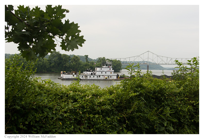
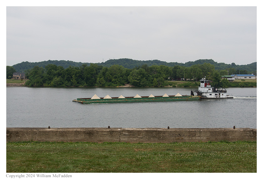
- Barges: "Laura S" | "Keith A. Blount"
- The Kanawha River and the Bartow Jones Memorial Bridge
- The confluence of the Kanawha and Ohio Rivers, and the Silver Memorial Bridge
- The Kanawha River
- The 1796 Mansion House
- The Chief Cornstalk Memorial
Description
On Wednesday, June 19, 2024, one member of the Southeast Ohio Radio Adventure Team performed successful simultaneous activations of Tu-Endie-Wei State Park and Lewis and Clark National Historic Trail in West Virginia as part of the Parks on the Air (POTA; link) program.
Hoping he had arrived early enough to beat the oncoming heat-wave, Eric McFadden, WD8RIF, visited Tu-Endie-Wei State Park to perform the simultaneous activations of Tu-Endie-Wei State Park and Lewis and Clark National Historic Trail with Josh Senefeld, N8VXR (blog), a POTA activator who hadn't yet performed a POTA activation in the state of West Virginia. Eric and Josh were accompanied by little black POTA-pup, Theo.
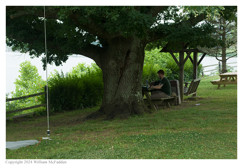
Eric, Josh, and Theo arrived at Tu-Endie-Wei State Park slightly before 1400 UTC. After walking Theo and considering places within the tiny four-acre state park to set up their stations, Josh selected a picnic table well shaded by an ancient and lovely oak tree for his station, and Eric chose set up his station on his folding camp-chair placed beneath a smaller oak tree.
Eric had offered Josh the chance to operate his Elecraft KX3, his Elecraft KX2, or his Yaesu FT-817ND, and Josh chose the Elecraft KX2 for this activation. Josh had done his homework and quickly got the KX2 set up for SSB operation, something Eric had never done because he's almost 100% CW on HF. Josh even went so far as to record himself calling "CQ Parks on the Air" with the KX2's voice-keyer, a feature Eric has never used with his KX2 or his KX3. Josh paired Eric's KX2 with his own Wolf River Coils (link) and a window-screen counterpoise. Placing the KX2 on the picnic table, Josh would be able to operate while enjoying the view of the confluence of the Kanawha and Ohio Rivers.
Josh's Wolf River Coils 17' telescoping whip
antenna and window-screen counterpoise.
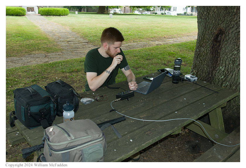
Josh operating Eric's Elecraft KX2, QRP SSB.
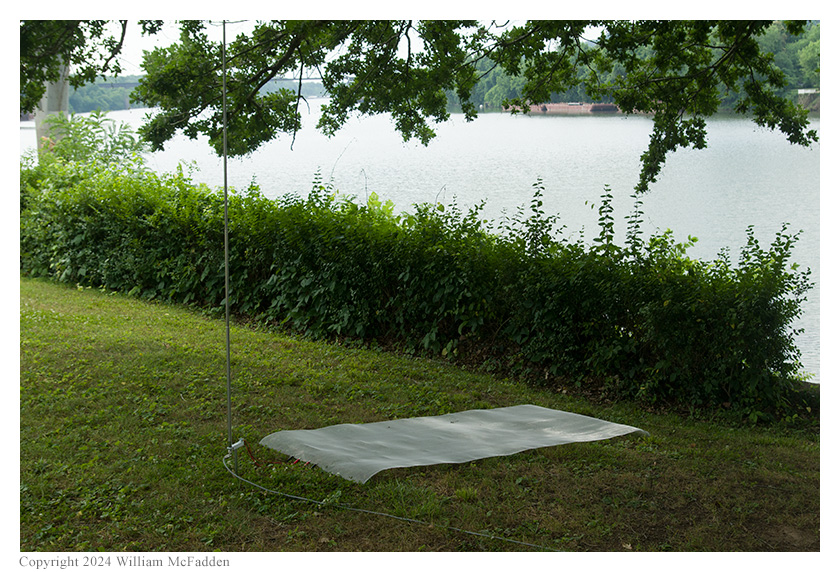
Eric strapped his 31' Jackite telescoping fiberglass mast to his camp-chair located under his oak tree, attached his 28½' wire to the top of the mast, and extended the mast right up through the tree. He laid three 17' counterpoise wires directly on the ground, placed his Elecraft KX3 on the camp-chair's pop-up table, and was on the air at 1417 UTC, with Theo-dog relaxing under the camp-chair.
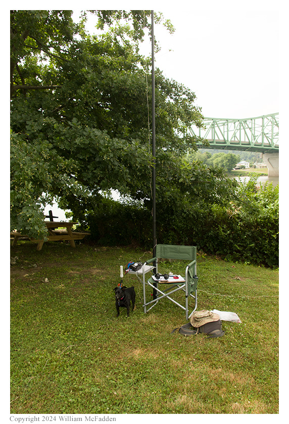
Theo guards Eric's station.
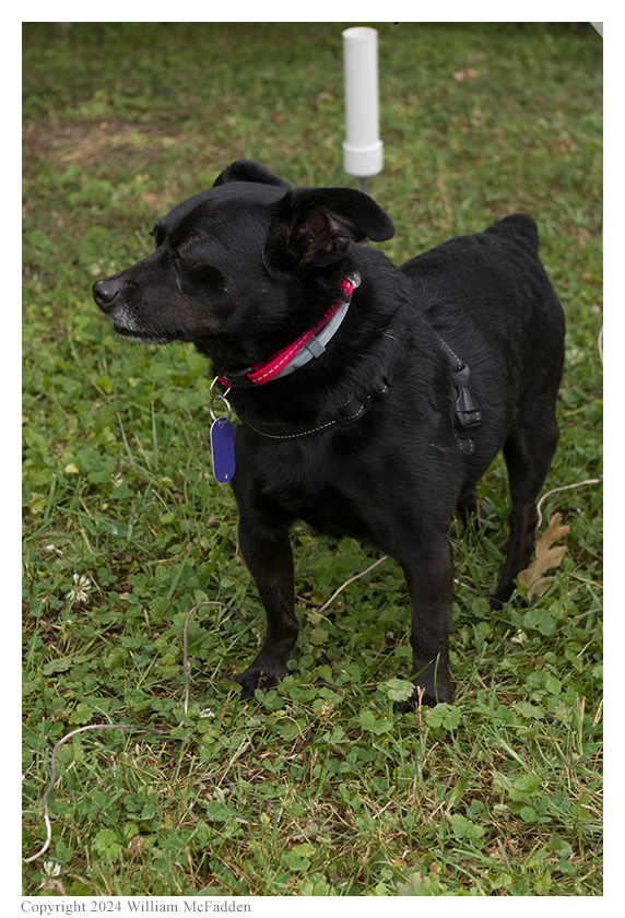
Theo!
As Eric had expected, he and Josh both had excellent cell-signal and would able to self-spot themselves on the POTA Spots website and to look for park-to-park (P2P) QSO opportunities.
The solar A-Index was 10 and the K-Index was 2, indications that HF band conditions might be rough.
With Josh starting his operation on 20m, Eric chose to start his on the harmonically unrelated 30m band. Unfortunately, even with Josh running only 5w, his 30m signal did cause interference in Eric's receiver, but it wasn't bad enough to force Eric to change bands. Eric found a clear frequency to run, began to call "CQ POTA", and was auto-spotted on POTA-Spots, an indication that HF propagation wasn't completely dead. Eric's first QSO came at 1420 UTC with KN4DY in Georgia. QSOs came steadily, if not quickly, with Eric's fifth QSO coming at 1430 UTC with N0FRC in Missouri. This run included QSOs with stations located in Georgia, Louisiana, Florida, New Jersey, and Missouri.
Switching to 40m, Eric found a clear frequency to run, began calling "CQ POTA", and was again auto-spotted on POTA Spots. His first QSO in this run came at 1436 UTC with N4KPT in Tennessee. The 40m band was more productive than the 30m band been, and Eric's tenth QSO in this run came at 1446 UTC with K2LML in New York. This run included a P2P QSO with KE4GTQ who was performing a two-fer activation of Kings Mountain National Military Park (US-0720) and Overmountain Victory National Historic Trail (US-4577) in South Carolina, and QSOs with stations located in Tennessee (3), Illinois, South Carolina, Kentucky, Ohio, Virginia, Maryland, and New York (2).
Pausing to hunt for P2P QSOs, at 1449 UTC Eric completed a P2P QSO on 40m with W4XK who was activating Wilson Cumberland Trail State Park (US-2955) in Tennessee.
When Josh validated his QRP SSB activation, Eric convinced him to switch to CW and at 1515 UTC he and Josh completed a two-fer P2P QSO on 40m, giving each other hunter credit for both Tu-Endie-Wei State Park and Lewis and Clark National Historic Trail.
In all, Eric logged twenty QSOs, including the pair of two-fer P2P QSOs. All of Eric's QSOs were CW and were made at the 5-watt level.
Josh has published his own activation report (link).
After tearing down their stations, Eric and Josh explored the park a bit more and and enjoyed a quick picnic lunch before starting their drive to Chief Cornstalk Wildlife Management Area, US-7048, for a second West Virginia POTA activation.
Barge "Laura S" on the Kanawha River.
Barge "Keith A. Blount" on the Ohio River.
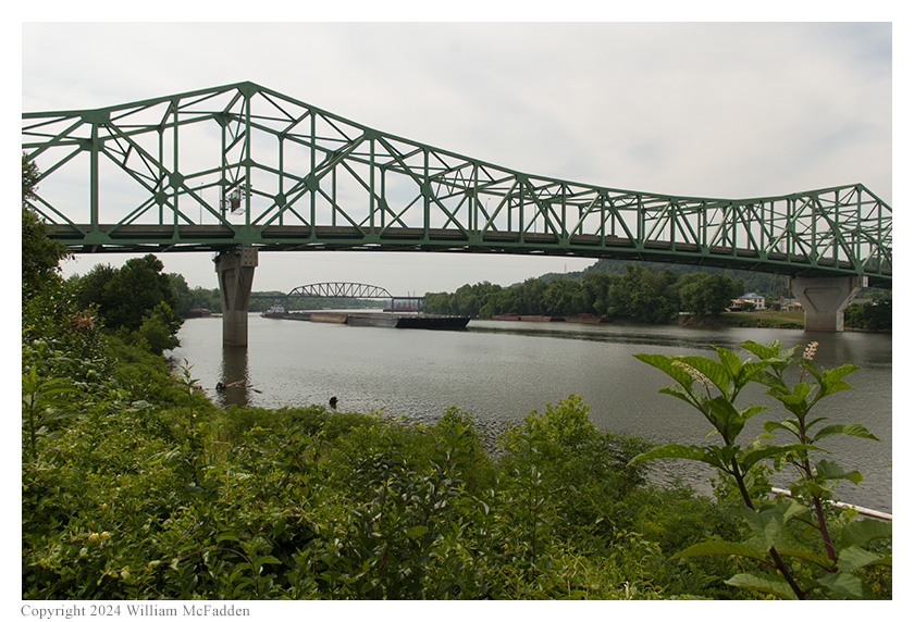
The Kanawha River and the Bartow Jones Memorial Bridge.
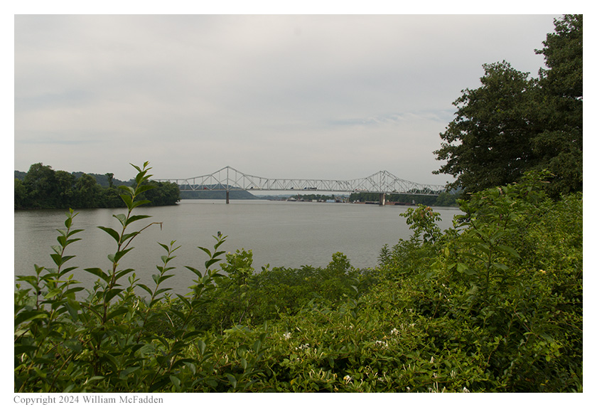
The confluence of tthe Kanawha and Ohio Rivers,
with the Silver Memorial Bridge in the distance.
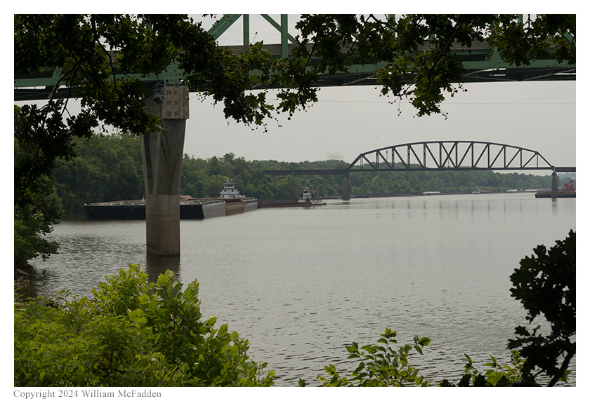
Looking under the Bartow Jones Memorial
Bridge along the Kanawha River.
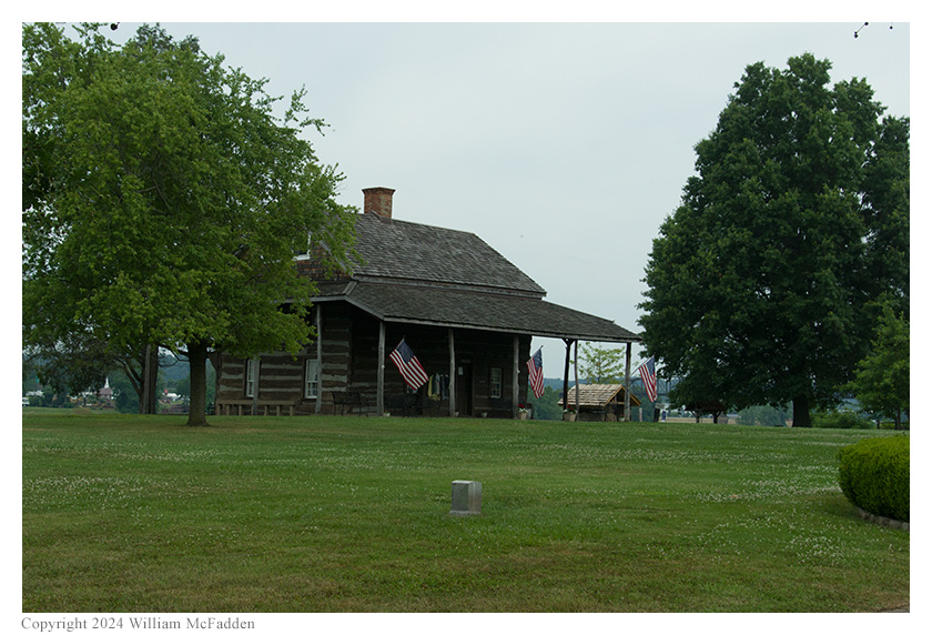
The 1796 Mansion House.
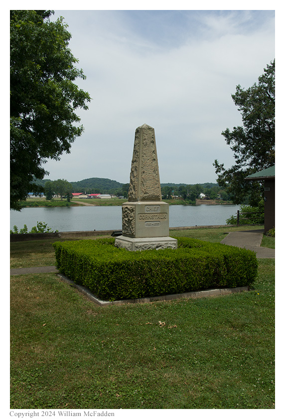
The Chief Cornstalk Memorial.
Both Eric and Josh had been quite comfortable in the shade provided by the old oak trees and were glad the serious heat hadn't yet arrived. (Spoiler alert: the serious heat had arrived by the time they reached Chief Cornstalk Wildlife Management Area!)
Eric also submitted his log to the World Wide Flora and Fauna in Amateur Radio (WWFF; link) program for Tu-Endie-Wei State Park, KFF-1823.
(return)