Pictures:
- Erie caboose C306. Photo taken 8 August, 1996.
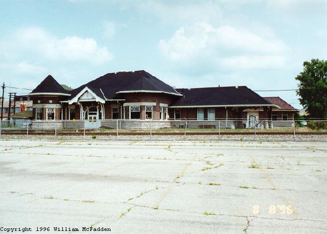
- The under-restoration Marion Union Station. Photo taken 8 August, 1996.
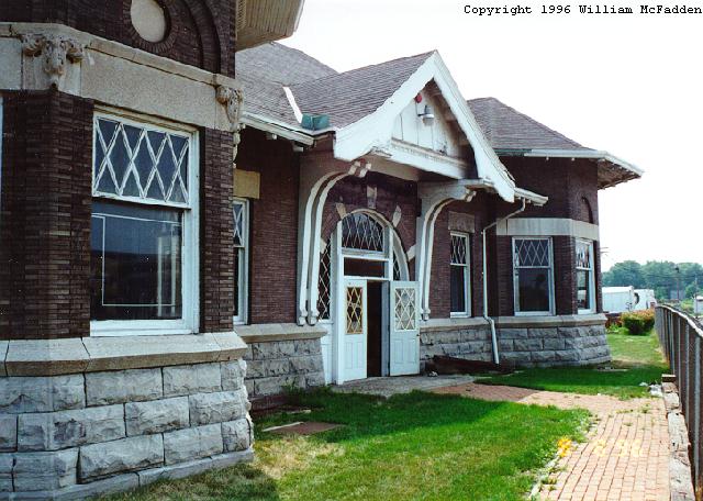
- Another view of the Marion Union Station. The hexagonal room to the left was the telegrapher's office, and has a lovely view of what's now the CSXT and Conrail lines. Photo taken 8 August, 1996.
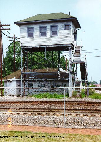
- The retired AC Interlocking Tower at the Marion Union Station. Photo taken 8 August, 1996.
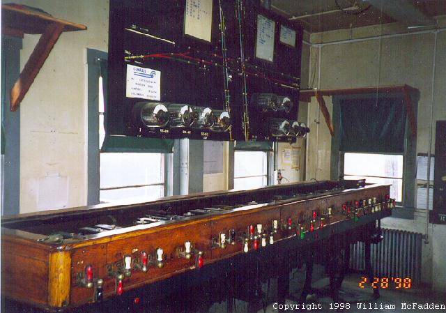
- Inside AC Tower. Photo taken 28 February, 1998.
The place to watch in Marion, Ohio is at the former Marion Union Station. Here the three big Ohio railroads all converge, with a pair of what used to be Conrail tracks (now CSX) passing behind the depot, a pair of NS tracks passing to the right of the station, and a pair of CSX tracks passing to the left of the depot. There are eight diamonds. Control of the four diamonds now is done remotely by CSX.
The Marion Union Station is currently under restoration. This station is being restored by the Marion Union Station Association. The station once served the Erie-Lackwanna; the Hocking Valley, Columbus, & Toledo; and the "Big Four". On display is an Erie "Radio" caboose. AC Tower, which used to be across the across the formerly-Conrail tracks from the depot is now directly behind the station and is undergoing restoration.
According to the North American Railroad Terminal Index Page, the "Marion Union Station was built through the urging of Warren G. Harding who later became the President of the United Sates. At the time he was publisher of the newspaper in Marion. Prior to the building of Marion Union Station, Marion had a dilapidated passenger coach serving as a ticket station. Marion Union Station figured prominently during World War Two. Troops stopped here for canteen service. In 1923, the body of President Warren G. Harding was brought through the station to be taken to his father's home for the funeral. Movie stars including Al Jolson came through the station during Harding's famous "Front Porch" campaign for the Presidency. A non-profit group purchased the station just before the wrecking ball would have torn it down. Restoration is about complete and the station serves as a railfan site for filming trains. It is said to be one of the hot spots in the nation for photography."
Here's an account of a typical day: On Saturday, February 28, 1998, I arrived about 10:10am to be stopped just shy of the depot by an NS mixed freight. By the time I'd left about 2pm, fourteen more trains had passed:
- 10:15am Conrail intermodal (UPS/mail train)
- 10:33am CSX coal empties
- 10:52am Conrail mixed freight, with B36-7
- 11:03am NS coal
- 11:45am NS mixed freight
- 11:49am CSX mixed freight
- 12:16pm Conrail intermodal (UPS/mail train)
- 12:46pm CSX coal, with SP and NS power
- 1:06pm Conrail mixed freight
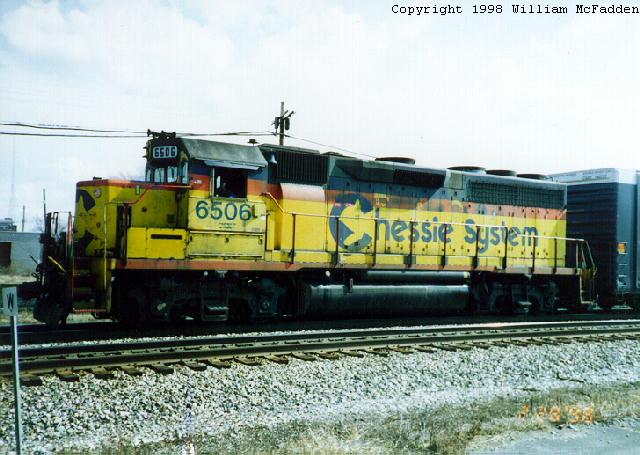
- 1:12pm CSX mixed freight, with Chessie System GP-40. Photo taken 28 February, 1998 with Canon Sure Shot Owl.
- 1:12pm NS autorack/intermodal with C40-9
- 1:35pm CSX coal empties
- 1:36pm NS mixed freight
- 1:54pm NS coal empties
On a subsequent visit, on Saturday, August 1, 1998, I was at the depot between 11:30am and 1:30pm and saw eight trains: three CSX, two NS, and three Conrail. On this day, there were several other railfans at the depot, including one who'd driven up from Dayton and another who'd driven up from Springfield.
| Radio Frequencies | Road Freq. | EOT | Dispatcher |
| CSX (formerly Conrail | 160.800 | 457.9375 | 160.800 |
| CSX | 160.230 | 457.9375 | 160.320 |
| Norfolk Southern | 161.190 | 161.115 |
| Defect Detectors | name | mileage point |
| CSX | 38.7 | |
| CSX (formerly Erie-Lackwanna) | Slick | 1 to 3 miles east of Marion |
| CSX (formerly Big Four) | Martel | |
| CSX (formerly Big Four) | New Bloomington | |
| NS | 38.6 |
All traffic past the diamonds is controlled by CSX on the Dispatch frequency. Each train needing to pass the depot will call CSX for clearance. "Track 1" for each railroad is the track nearest the depot.
There are also railfanning opportunities elsewhere in Marion. West of the station on 95 is a small CSX (formerly Conrail) yard. East of the Station and just north of 95 Conrail serves several industries. Just north of Marion, visible from US23, the NS tracks pass beneath the remains of a concrete coaling bunker.
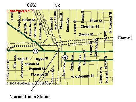 |
The Conrail lines now belong to CSX Map Copyright 1997 GeoSystems Global Group |
Visit Dave Dupler's Northern Ohio Railroad Photos page for photos of activity at Marion Union Station in 1975. 1976, and 1989.
Maps courtesy of MapQuest Interactive Atlas.